
Population 6,577 (2011 census) LGA(s) Mid-Coast Council Green Point Picketts Valley Postal code 2251 Federal division Division of Robertson | Postcode(s) 2251 State electorate(s) Terrigal Area 8.4 km² Parish Kincumber | |
 | ||
Location 7 km (4 mi) SE of Gosford
9 km (6 mi) W of Terrigal
85 km (53 mi) from Sydney | ||
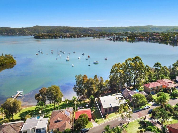
Green Point is a south-eastern suburb of the Central Coast region of New South Wales, Australia between Erina and Kincumber along Avoca Drive. It is part of the Central Coast Council local government area.
Map of Green Point NSW 2251, Australia
The suburb contains a small shopping complex situated along Avoca Drive, with a Coles, butcher, grocer, newsagent and other stores. There is also an Aldi supermarket in a separate location. Much of Green Point is adjacent to Brisbane Water, providing water views to many residents.
Extensive roadworks were recently completed along Avoca Drive, widening traffic from one to two lanes in each direction, to improve traffic flow.
The suburb contains one school, Green Point Christian College, one of many private schools on the Central Coast.
References
Green Point, New South Wales Wikipedia(Text) CC BY-SA