
Country United States County Clay FIPS code 20-28425 Elevation 421 m Zip code 67447 Local time Thursday 7:03 PM | Time zone Central (CST) (UTC-6) GNIS feature ID 0476044 Area 50 ha Population 130 (2013) Area code 785 | |
 | ||
Weather 9°C, Wind NE at 19 km/h, 36% Humidity | ||
Green is a city in Clay County, Kansas, United States. As of the 2010 census, the city population was 128.
Contents
Map of Green, KS 67447, USA
History
Green was incorporated in 1908. It is named in honor of the fourth Governor of Kansas, Nehemiah Green, who offered to donate a church bell to the town in exchange for the naming rights.
A post office was opened in Powellsburgh (an extinct town) in 1872, but it was moved to Green in 1881.
Green was a shipping point on the Union Pacific Railroad.
Geography
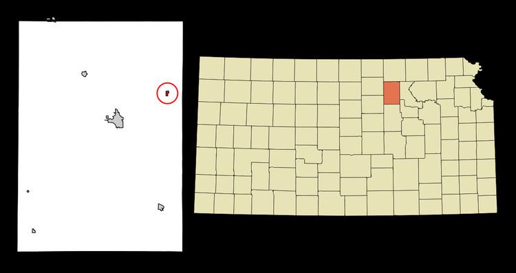
Green is located at 39°25′49″N 96°59′57″W (39.430247, -96.999195). According to the United States Census Bureau, the city has a total area of 0.20 square miles (0.52 km2), all of it land.
2010 census
As of the census of 2010, there were 128 people, 54 households, and 34 families residing in the city. The population density was 640.0 inhabitants per square mile (247.1/km2). There were 68 housing units at an average density of 340.0 per square mile (131.3/km2). The racial makeup of the city was 97.7% White, 1.6% Native American, and 0.8% from two or more races. Hispanic or Latino of any race were 2.3% of the population.
There were 54 households of which 31.5% had children under the age of 18 living with them, 48.1% were married couples living together, 7.4% had a female householder with no husband present, 7.4% had a male householder with no wife present, and 37.0% were non-families. 31.5% of all households were made up of individuals and 16.7% had someone living alone who was 65 years of age or older. The average household size was 2.37 and the average family size was 3.03.
The median age in the city was 36.6 years. 28.1% of residents were under the age of 18; 3% were between the ages of 18 and 24; 29% were from 25 to 44; 27.3% were from 45 to 64; and 12.5% were 65 years of age or older. The gender makeup of the city was 50.0% male and 50.0% female.
2000 census
As of the census of 2000, there were 147 people, 58 households, and 41 families residing in the city. The population density was 752.8 people per square mile (283.8/km2). There were 71 housing units at an average density of 363.6 per square mile (137.1/km2). The racial makeup of the city was 96.60% White, 0.68% African American and 2.72% Native American. Hispanic or Latino of any race were 1.36% of the population.
There were 58 households out of which 41.4% had children under the age of 18 living with them, 50.0% were married couples living together, 13.8% had a female householder with no husband present, and 29.3% were non-families. 24.1% of all households were made up of individuals and 10.3% had someone living alone who was 65 years of age or older. The average household size was 2.53 and the average family size was 3.05.
In the city, the population was spread out with 34.0% under the age of 18, 8.2% from 18 to 24, 29.3% from 25 to 44, 19.0% from 45 to 64, and 9.5% who were 65 years of age or older. The median age was 30 years. For every 100 females there were 96.0 males. For every 100 females age 18 and over, there were 98.0 males.
The median income for a household in the city was $27,083, and the median income for a family was $29,167. Males had a median income of $21,750 versus $27,500 for females. The per capita income for the city was $11,171. There were 5.3% of families and 4.4% of the population living below the poverty line, including 5.6% of under eighteens and none of those over 64.