
Population 4,404 (2011 Census) Civil parish Grange Park | OS grid reference SP675552 Local time Saturday 11:36 AM Dialling code 01604 | |
 | ||
Weather 14°C, Wind W at 27 km/h, 75% Humidity | ||
Grange Park is an affluent residential housing estate on the edge of Northampton but just outside the Borough of Northampton. It is in the area of South Northamptonshire Council. Some residents refer to its status as a "village", although in reality it is an extension to the Northampton urban area. It is 3 miles (5 km) south of Northampton town centre, in the shire county of Northamptonshire (Northants). It is very close to the M1 London to Yorkshire motorway junction 15, 65 miles (105 km) north of London and 45 miles (72 km) southeast of Birmingham.
Contents
- Map of Grange Park UK
- Demographics
- Community
- Industrial
- Schools
- New developments
- Political structure
- Transport
- History
- References
Map of Grange Park, UK
Demographics
The 2001 Census shows a population of 327 people in the parish in 118 dwellings, however, the area was relatively undeveloped at that time. By the end of 2007 the area had grown to 1,439 houses with an estimated population of 3,500 according to the 2008 public electoral roll, compiled in 2007, which excludes minors and also a small number of people for privacy reasons. The 2011 Census indicated a population of 4,404.
Community
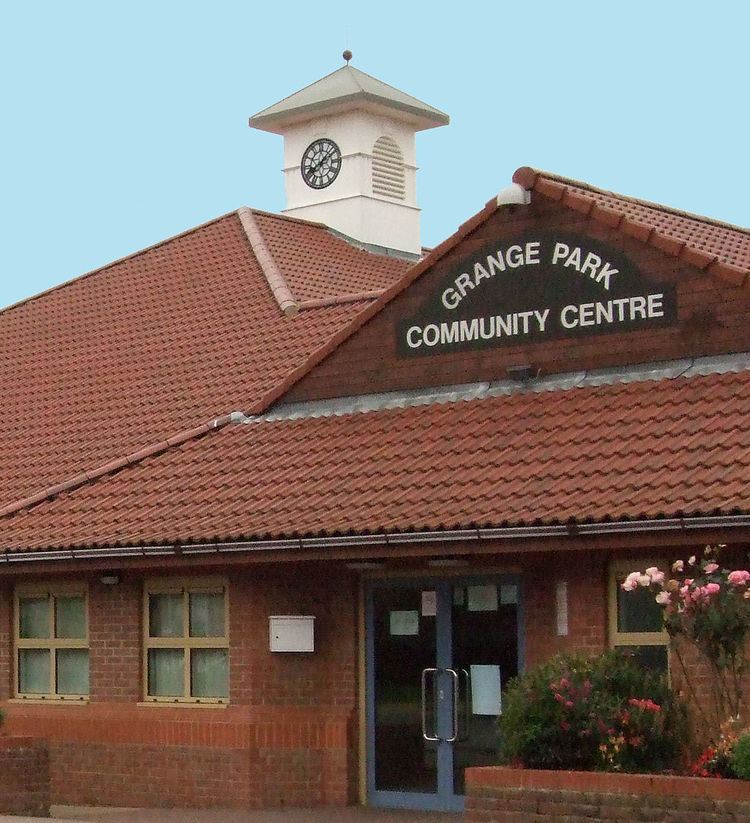
The estate has a co op supermarket, a community centre and a sports pavilion. There are also two hotels (Campanile & Holiday Inn Express) and a Harvester alongside the M1 junction. The estate has a pub, the Grange Inn Public House, a country park bordering the adjacent village of Quinton, a cricket club for juniors and seniors, a youth club and scouts group. Just across the other side of the A45 from the estate is the Collingtree Park Golf Course.
Industrial
An industrial estate largely consisting of warehouses or logistics companies borders to the south west between the estate and the motorway. There is a smaller business estate at the border with the village of Wootton to the north west.
A recycling works and park and ride facility have been mentioned as possible developments for the site of an old sand pit and closed domestic refuse tip to the west alongside the A45 trunk road.
Schools
There is a primary school Woodland View Primary in School Lane.
The estate is in the catchment area, for children of statutory school leaving age, of Caroline Chisholm School A newer secondary school, Caroline Chisholm School, which caters for children from age 4 to 19, is within walking distance at Wootton. Pupils who live in the linked area associated with the school which includes Grange Park are included in the admission criteria - refer to the school for full details.
New developments
A further development of 450 new homes together with an hôtel has been agreed by the West Northamptonshire Development Corporation. The development is on a site bounded by the A45 main road, an old sand pit used as a domestic refuse site but now closed, and the existing housing estate. The site was originally proposed as a site for an IKEA store in September 2002, but after local opposition in 2003, it was built in Milton Keynes instead.
A major urban extension of 2,000 houses, of which around 35% would be affordable was proposed by Bovis Homes in July 2008 at Collingtree Park, just over the A45 from Grange Park.
Political structure
The estate has a parish council with twelve members elected every four years. The local district council is South Northamptonshire where it forms the 2-member Grange ward.
Transport
The county of Northants is at a north-south and east-west rail, motorway and fast road transport network. The Northampton Loop of the West Coast Main Line carries trains from Northampton to London Euston via Milton Keynes.
The estate borders on the M1 to the south-east and A45 to the west and north.
Typical travel times in minutes by road (peak times in italics) are: central London (via M1) 75 (110), Birmingham (via M1/M6) 45 (60), Manchester, (via M1/M6/M62) 120 (175), Leicester (via M1) 50 (65), Oxford (via A43) 50 (60), Cambridge (via A45/A14) 85 (130), Milton Keynes (via A508) 20 (30). Peak travel times by rail by Govia London Midland and Virgin Trains services in minutes are: from Northampton to Central London 55, to Birmingham 65; from Milton Keynes to Central London 40 and Manchester 120. Airports at Heathrow, Gatwick, and London Stansted as well as Birmingham Airport are all within easy reach.
History
The area was developed from agricultural land around 1999.