
OS grid reference SW915505 | Sovereign state United Kingdom Postcode district TR2 | |
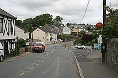 | ||
Grampound Road is a village in the parish of Ladock (where the 2011 census population was included), Cornwall, England, 3 kilometres (2 mi) north west of Grampound
Map of Grampound Road, Truro, UK
The railway station of that name was situated here; it was opened on 4 May 1859 and closed in 1964. A small village known as Grampound Road grew up around the railway station and continues to expand despite the station closing (along with other stations on the line) on 5 October 1964.
References
Grampound Road Wikipedia(Text) CC BY-SA