
Country United States ZIP codes 72315, 72319 Area 4.3 km² Population 3,397 (2013) Area code 870 | Time zone Central (CST) (UTC-6) FIPS code 05-27700 Elevation 76 m Local time Friday 4:24 AM | |
 | ||
Weather 9°C, Wind S at 14 km/h, 62% Humidity | ||
Lightning storm in gosnell arkansas pt 1
Gosnell is a city in Mississippi County, Arkansas, United States. The population was 3,548 at the 2010 census.
Contents
- Lightning storm in gosnell arkansas pt 1
- Map of Gosnell AR 72315 USA
- Geography
- History
- Historical sites
- 2010 census
- 2000 census
- Economy
- Annual cultural events
- Education
- Government and politics
- State and federal representation
- Climate
- Tornado activity
- Earthquake activity
- Natural disasters
- References
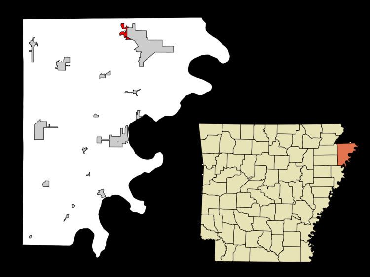
Map of Gosnell, AR 72315, USA
Geography
Gosnell is located at 35°57′48″N 89°58′2″W (35.963308, -89.967224).
According to the United States Census Bureau, the city has a total area of 1.7 square miles (4.4 km2), all land.
History
The Gosnell region was surrounded by water in its early days. It is bordered on the west by Big Lake, which in the days before the automobile and railroads was used as a boat transportation route linking the settlement to the larger cities of Arkansas, Missouri, and Tennessee. Landowners along Big Lake took advantage of a thriving commercial hunting and fishing business. Pelts and packed fish could be shipped to market along the lake or by the two bayous to the Mississippi River.
To the east of the settlement is the Pemiscot Bayou. The road from Blytheville passed the Indian mound and store before traveling across the Pemiscot Bayou. Families with land along the Pemiscot traveled in boats into the Lumerate Bayou, which ran through Blytheville’s business district. The road to Gosnell came to be called the Pole Road. When stretches of the road became bad, the community would turn out to cut logs to place across the mud of the road, making it passable again.
Because the land was sparsely settled, it was of little concern to either side during the Civil War. All of Mississippi County had fewer than 4,000 residents at this time. Men from the area joined Confederate units from other parts of Arkansas. Aside from a few Union raids from Missouri, the county did not suffer much from the war.
Much of the land between Blytheville and Big Lake was purchased in the late 1800s by Lemael Gosnell, a dentist and pioneer farmer. In time, the community came to be named for him.
Gosnell was incorporated as a first-class city on March 12, 1968. Gosnell’s first mayor after incorporation was Andy Bevill. Since then, Gosnell has had only three mayors: Carl Ledbetter, Dick Reams and currently Don Marshall.
Historical sites
Leaving Blytheville on Chickasawba Avenue one reaches the Gosnell Road upon, after traveling one and three-tenths miles one comes to the place of the famous Chickasawba Indian Mound twenty five feet high and base circumference approximately one hundred-thirty feet. This mound must have been either a Signal or a Temple Mound as no pottery or skeleton bones have been found here.
2010 census
As of the census of 2010, there were 3,548 people, 1,387 households, and 951 families residing in the city. The racial makeup of the city was 72.9% White, 22.0% Black or African American, 0.4% Native American, 1.0% Asian, 1.6% from other races, and 2.1% from two or more races. Hispanic or Latino of any race were 3.5% of the population.
There were 1,238 households out of which 48.1% had children under the age of 18 living with them, 45.9% were married couples living together, 23.2% had a female householder with no husband present, 7.8% had a male householder with no wife present, and 23.2% were non-families. 19.2% of all households were made up of individuals and 4.8% had someone living alone who was 65 years of age or older. The average household size was 2.87 and the average family size was 3.26.
The median income for a household in the city was $43,722, and the median income for a family was $46,389. The per capita income for the city was $15,917.
2000 census
As of the census of 2000, there were 3,968 people, 1,369 households, and 1,074 families residing in the city. The population density was 2,367.1 people per square mile (911.9/km²). There were 1,578 housing units at an average density of 941.3 per square mile (362.7/km²). The racial makeup of the city was 80.12% White, 15.15% Black or African American, 0.43% Native American, 1.01% Asian, 1.86% from other races, and 1.44% from two or more races. Hispanic or Latino of any race were 3.45% of the population.
There were 1,369 households out of which 48.3% had children under the age of 18 living with them, 54.9% were married couples living together, 18.4% had a female householder with no husband present, and 21.5% were non-families. 17.5% of all households were made up of individuals and 4.1% had someone living alone who was 65 years of age or older. The average household size was 2.90 and the average family size was 3.29.
In the city, the population was spread out with 34.9% under the age of 18, 10.8% from 18 to 24, 32.0% from 25 to 44, 17.5% from 45 to 64, and 4.8% who were 65 years of age or older. The median age was 28 years. For every 100 females there were 96.7 males. For every 100 females age 18 and over, there were 92.1 males.
The median income for a household in the city was $31,423, and the median income for a family was $37,176. Males had a median income of $30,995 versus $17,625 for females. The per capita income for the city was $13,371. About 15.5% of families and 17.1% of the population were below the poverty line, including 16.5% of those under age 18 and 31.4% of those age 65 or over.
Economy
Gosnell used to depend on the nearby Blytheville/Eaker Air Force Base but since its closing in the early 1990s, the city has lost many of its inhabitants. The city is home to the Gosnell School District, which as of 2011 has an enrollment of 1438 K-12.
Annual cultural events
Gosnell's Annual Cotton Festival in October.
Education
Public education is available to elementary and secondary school students at Gosnell School District, which leads to graduation from Gosnell High School. The district and high school mascot and athletic emblem is the Pirate with the spirit colors of blue and gold.
Government and politics
Gosnell Mayor - Don Marshall
Ward 1 -
Position 1 - Eric Blount
Position 2 - Tammie Fulks
Ward 2 -
Position 1 - Mellissa Sellers
Position 2 - Rhonda Smith
Ward 3 -
Position 1 - Nita Reams
Position 2 - Ed Guthrie
State and federal representation
Arkansas's 1st congressional district - United States Congressman Rick Crawford
United States Senator - Mark Pryor
The United States Postal Service operates one post office in Gosnell.
see also Politics and government of Arkansas
Climate
Gosnell has a humid subtropical climate (Köppen climate classification Cfa).
Totals and averages
Annual average high temperature 70.2 °F
Annual average low temperature 51.0 °F
Average temperature 60.6 °F
Average annual precipitation 50.3 in.
Tornado activity
Gosnell-area historical tornado activity is slightly above Arkansas state average. It is 220% greater than the overall U.S. average. On 5/15/1968, a category F4 (max. wind speeds 207-260 mph) tornado 5.6 miles away from the Gosnell city center killed 35 people and injured 364 people and caused between $5000 and $50,000 in damages.
On 4/16/1998, a category F4 tornado 10.1 miles away from the city center killed 2 people and injured 12 people and caused $350,000 in damages.
Earthquake activity
Gosnell-area historical earthquake activity is significantly above Arkansas state average. It is 91% greater than the overall U.S. average.
On 3/25/1976 at 00:41:20, a magnitude 5.0 (4.9 MB, 5.0 LG, Class: Moderate, Intensity: VI - VII) earthquake occurred 30.3 miles away from the city center On 5/4/1991 at 01:18:54, a magnitude 5.0 (4.4 MB, 4.6 LG, 5.0 LG, Depth: 3.1 mi) earthquake occurred 42.3 miles away from Gosnell center On 4/27/1989 at 16:47:49, a magnitude 4.7 (4.6 MB, 4.7 LG, 4.3 LG, Class: Light, Intensity: IV - V) earthquake occurred 11.5 miles away from the city center On 9/26/1990 at 13:18:51, a magnitude 5.0 (4.7 MB, 4.8 LG, 5.0 LG, Depth: 7.7 mi) earthquake occurred 86.6 miles away from the city center On 3/25/1976 at 01:00:11, a magnitude 4.5 (4.1 MB, 4.5 LG) earthquake occurred 37.7 miles away from Gosnell center On 11/29/1996 at 05:41:33, a magnitude 4.3 (4.3 LG, 4.1 LG, Depth: 12.6 mi) earthquake occurred 3.8 miles away from the city center Magnitude types: regional Lg-wave magnitude (LG), body-wave magnitude (MB)
Natural disasters
The number of natural disasters in Mississippi County (11) is near the US average (12). Major Disasters (Presidential) Declared: 7 Emergencies Declared: 4
Causes of natural disasters: Storms: 6, Floods: 5, Tornadoes: 4, Winter Storms: 4, Hurricane: 1 (Note: Some incidents may be assigned to more than one category).