
Time zone CST (UTC-6) Elevation 388 m Population 1,656 (2000) Area code 479 | Established 1878 GNIS feature ID 69788 Area 79.8 km² Local time Friday 4:10 AM | |
 | ||
Weather 13°C, Wind S at 19 km/h, 79% Humidity | ||
Goshen Township is one of thirty-seven townships in Washington County, Arkansas, USA. As of the 2000 census, its total population was 1,656. The township contains the Town of Goshen and some surrounding unincorporated areas.
Contents
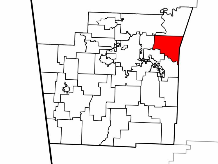
Map of Goshen Township, AR, USA
Geography
According to the United States Census Bureau, Goshen Township covers an area of 30.8 square miles (80 km2), with 30.4 square miles (79 km2) land and the remaining 0.4 square miles (1.0 km2) water. Goshen Township was formed from parts of Richland Township and Brush Creek Township. Part of Goshen Township was given to Wyman Township near the end of the 19th century.
Cities, towns, villages
Cemeteries
The township contains three cemeteries: Culwell Cemetery, Mayfield Cemetery, and Oxford Bend Cemetery.
Major routes
References
Goshen Township, Washington County, Arkansas Wikipedia(Text) CC BY-SA