
Country China Area 12,961 km² Province Tibet | Time zone China Standard (UTC+8) Local time Friday 1:56 AM | |
 | ||
Weather -16°C, Wind SE at 5 km/h, 87% Humidity Points of interest Basong Co, Pagsum Lake, Mila Mountain | ||
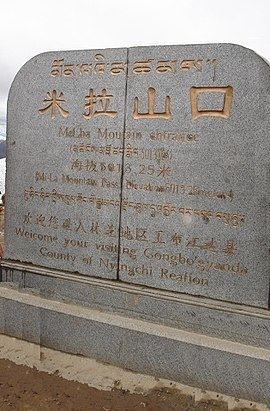
Gongbo'gyamda County (Tibetan: ཀོང་པོ་རྒྱ་མདའ་རྫོང་, Wylie: kong po rgya mda' rdzong; Chinese: 工布江达县; Pinyin: Gōngbùjiāngdá Xiàn) is a county of the Nyingtri Prefecture in the Tibet Autonomous Region, lying approximately 275 km east of Lhasa at its central point. Its main geographical feature is Lake Basum Tso, a green lake of some 3700 metres above sea level.
Contents
Map of Gongbo'gyamda, Nyingchi, Tibet, China
Etymology
"Gongbo'gyamda" means "great outlet of the valley" in Tibetan.
Geography
Gongbo'gyamda County is located in the east of the Tibet Autonomous Region, to the south of the Nyainqentanglha Mountains, to the north of the Yarlung Tsangpo River and in the area of the middle branches of the Nyang River. With a population of 22,000, the county covers an area of 12,886 square kilometres. The average altitude of the county is 3,500 metres above sea level. The Gonggo Lake, with a total area of 26 square kilometres, is a famous lake.
Transport
Economy and reserves
Water resources is abundant in Gongbo'gyamda County. The species of animals include leopard, red deer, black bear, brown bear, otter, monkey and black-necked crane, etc. There are almost a hundred of species of plants in the county, such as aweto, fritillaria and snow lotus, etc.
Block raising is the main industry of the county. The Sichuan-Tibet Highway crosses the county. The total length of all roads reaches 380 kilometres.