
District Rotenburg (Wümme) Time zone CET/CEST (UTC+1/+2) Area 122.9 km² Local time Wednesday 7:44 PM Dialling code 04763 | Elevation 10 m (30 ft) Postal codes 27442 Population 9,396 (31 Dec 2008) Postal code 27442 | |
 | ||
Weather 7°C, Wind W at 11 km/h, 82% Humidity | ||
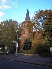
Gnarrenburg is a municipality in the district of Rotenburg, in Lower Saxony, Germany. It is situated approximately 15 km southwest of Bremervörde, and 40 km northeast of Bremen.
Map of 27442 Gnarrenburg, Germany
Gnarrenburg belonged to the Prince-Archbishopric of Bremen. In 1648 the Prince-Archbishopric was transformed into the Duchy of Bremen, which was first ruled in personal union by the Swedish and from 1715 on by the Hanoverian Crown. In 1823 the Duchy was abolished and its territory became part of the Stade Region.
References
Gnarrenburg Wikipedia(Text) CC BY-SA