
Number Zone (+48) 14 Area 86.02 km² | Time zone CET (UTC+1) Vehicle registration KTA Population 9,774 (2006) | |
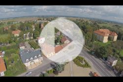 | ||
Gmina Radłów is an urban-rural gmina (administrative district) in Tarnów County, Lesser Poland Voivodeship, in southern Poland. Its seat is the town of Radłów, which lies approximately 13 kilometres (8 mi) north-west of Tarnów and 66 km (41 mi) east of the regional capital Kraków.
Contents
Map of Gmina Rad%C5%82%C3%B3w, Poland
The gmina covers an area of 86.02 square kilometres (33.2 sq mi), and as of 2006 its total population is 9,774.
Villages
Apart from the town of Radłów, Gmina Radłów contains the villages and settlements of Biskupice Radłowskie, Brzeźnica, Glów, Łęka Siedlecka, Marcinkowice, Niwka, Przybysławice, Sanoka, Siedlec, Wał-Ruda, Wola Radłowska, Zabawa and Zdrochec.
Neighbouring gminas
Gmina Radłów is bordered by the gminas of Borzęcin, Szczurowa, Wierzchosławice, Wietrzychowice and Żabno.
References
Gmina Radłów, Lesser Poland Voivodeship Wikipedia(Text) CC BY-SA