
Length 135 mi (217 km) | Location Wales Use Hiking | |
 | ||
Glyndŵr's Way (Welsh: Llwybr Glyndŵr) is a long distance footpath in mid Wales. It runs for 135 miles (217 km) in an extended loop through Powys between Knighton and Welshpool.
Contents
Map of Glyndwr's Way, Knighton LD7 1LG, UK
History
Glyndŵr's Way was granted National Trail status in 2000 to mark the beginning of the third millennium and the 600th anniversary of an ill-fated but nevertheless long-running rebellion in 1400. Its name derives from the early 15th century Welsh prince and folk hero Owain Glyndŵr.
Route
With Offa's Dyke Path and the Pembrokeshire Coast Path, Glyndŵr's Way makes up the third National Trail in Wales.
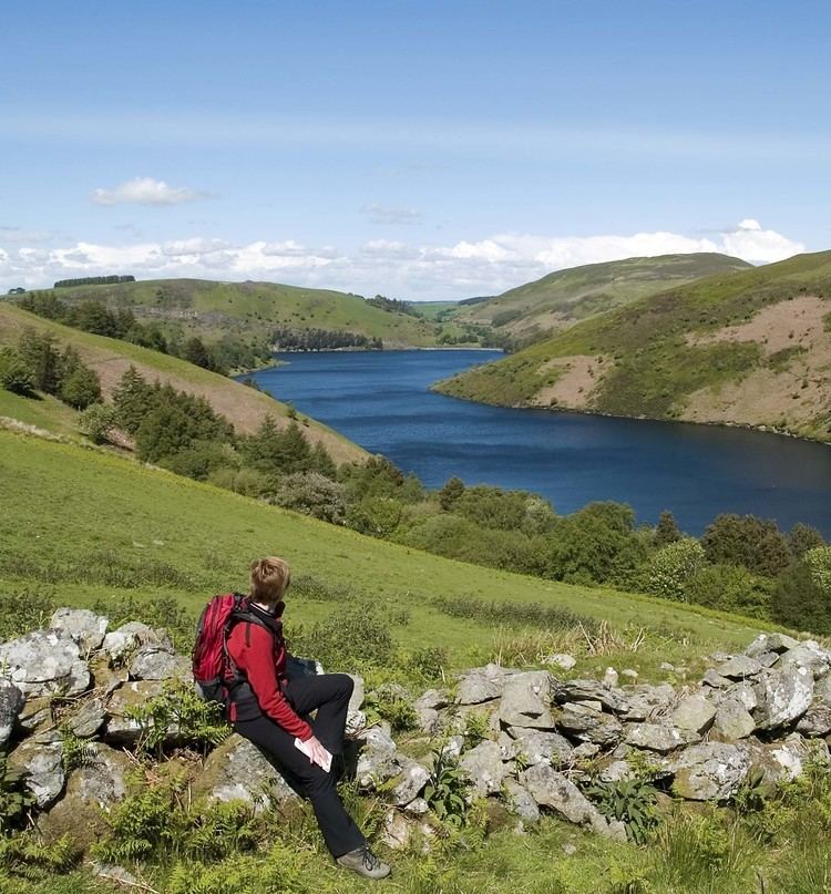
The footpath officially begins in Knighton, on the English border, where it links with Offa's Dyke Path. Running in roughly a horseshoe shape, it passes small market towns such as Llanidloes and quiet villages including Abbeycwmhir and Llanbadarn Fynydd, traversing central Mid Wales to Machynlleth near the Dyfi estuary and returning across Wales via Llanbrynmair, Llangadfan and Lake Vyrnwy and the valley of the River Vyrnwy to Welshpool, close to the English border.
Some walkers complete it start to finish in maybe 10 days or so, some complete it in sections over various weekends and some just select the section that appeals to them and walk that. The route is varied, often challenging and should not be attempted without preparation. Accommodation can be booked all along the route at hotels, guest houses or campsites.