
Geocode 30029 Area 8.08 km² Population 9,052 (2013) Area code 708 | Incorporated 1903 Website villageofglenwood.com Zip code 60425 Local time Tuesday 4:33 PM | |
 | ||
Weather -4°C, Wind N at 23 km/h, 74% Humidity | ||
Commentary village cemetery yard display glenwood illinois
Glenwood is a village in Cook County, Illinois, United States. The population was 8,969 at the 2010 census.
Contents
- Commentary village cemetery yard display glenwood illinois
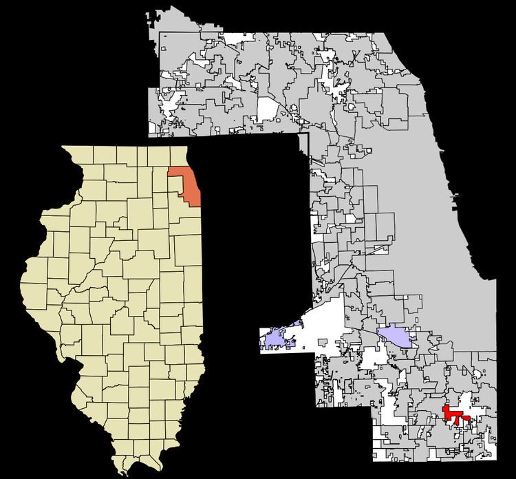
- Map of Glenwood IL USA
- Geography
- Demographics
- Government
- Education
- Places of worship
- References
Map of Glenwood, IL, USA
Geography
Glenwood is located at 41°32′42″N 87°36′43″W (41.544943, -87.612052).
According to the 2010 census, Glenwood has a total area of 3.12 square miles (8.08 km2), all land.
The Glenwood Shoreline, an ancient shoreline of Lake Chicago, is within the village. The village is almost completely surrounded by forest preserves, as is the nearby village of Thornton.
The neighboring villages are Homewood to the west, Thornton to the north, Lynwood to the east, and Ford Heights and Chicago Heights to the south.
Demographics
As of the census of 2010 there were 8,969 residents of Glenwood. The median age was 39.5. The racial composition of the population was 27.3% white, 66.7% black or African American, 0.1% Native American, 0.3% Asian, 0.1% Pacific Islander, 3.3% from some other race and 2.2% reporting two or more races. 7.4% of the population was Hispanic or Latino of any race.
As of the census of 2000, there were 9,000 people, 3,373 households, and 2,472 families residing in the village. The population density was 3,350.1 people per square mile (1,291.8/km²). There were 3,461 housing units at an average density of 1,288.3 per square mile (496.8/km²). The racial makeup of the village was 51.28% White, 44.53% African American, 0.10% Native American, 0.62% Asian, 0.10% Pacific Islander, 2.26% from other races, and 1.11% from two or more races. Hispanic or Latino of any race were 5.02% of the population.
There were 3,373 households out of which 31.7% had children under the age of 18 living with them, 53.3% were married couples living together, 15.7% had a female householder with no husband present, and 26.7% were non-families. 23.7% of all households were made up of individuals and 9.7% had someone living alone who was 65 years of age or older. The average household size was 2.67 and the average family size was 3.16.
In the village, the population was spread out with 25.4% under the age of 18, 7.4% from 18 to 24, 27.1% from 25 to 44, 27.1% from 45 to 64, and 13.0% who were 65 years of age or older. The median age was 39 years. For every 100 females there were 87.2 males. For every 100 females age 18 and over, there were 82.3 males.
The median income for a household in the village was $53,894, and the median income for a family was $67,161. Males had a median income of $46,439 versus $32,358 for females. The per capita income for the village was $24,356. About 3.3% of families and 3.7% of the population were below the poverty line, including 5.4% of those under age 18 and 3.4% of those age 65 or over.
Government
Glenwood is in Illinois' 2nd congressional district.
Education
Public schools in Glenwood include Longwood Elementary School, Hickory Bend Elementary School, Brookwood Middle School, and Brookwood Junior High School. Glenwood Academy (formerly called Glenwood School for Boy and Glenwood School for Boys and Girls) is also located in Glenwood.
Places of worship
St. Andrews Church, St. John Catholic Church, The Spiritual Israel Temple of Glenwood, Calvary Baptist Church of Glenwood and Glenwood Bible Church.