
Country New Zealand Surveyed 1864 Postcode 9372 Local time Wednesday 10:03 AM | Time zone NZST (UTC+12) Population 363 (2013) Area code 03 | |
 | ||
Territorial authority Weather 13°C, Wind N at 3 km/h, 86% Humidity Points of interest Glenorchy Lagoon, Mount Alfred Ridge, Earnslaw Burn, Glenorchy Animal Experience | ||
Glenorchy is a small settlement at the northern end of Lake Wakatipu in the South Island region of Otago, New Zealand. It is approximately 45 km (28 mi) by road or boat from Queenstown, the nearest large town. There are several pubs, a café and a range of small shops in the town catering mainly to tourists but also to the small resident population. There is also a small airstrip which caters to small planes.
Contents
Map of Glenorchy 9372, New Zealand
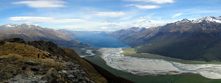
The Dart River and Rees River flow into the head of Lake Wakatipu next to Glenorchy.
Naming
Glenorchy was named after Glen Orchy in Argyll, Scotland.
Activities
Glenorchy is a popular tourist spot, close to many tramping tracks. It lies near the borders of Mount Aspiring National Park and Fiordland National Park. The Routeburn Track, one of the New Zealand Great Walks can be accessed by passing through Glenorchy. Lesser known tracks such as the Greenstone and Caples Tracks and the Rees and Dart Tracks can also be accessed.
Some of the activities that can be experienced in or near Glenorchy include: canyoning, fly fishing, jet boating, horse riding, kayaking, mountain biking, skiing, snowboarding, skydiving and boating. Just past the Glenorchy Golf Club is a circular public boardwalk which passes through the Glenorchy Lagoon and is a popular short walk for tourists and locals.