
Population 7,558 (2011 census) Postcode(s) 2167 Postal code 2167 | Established 1881 Founded 1881 | |
 | ||
Location 40 km (25 mi) SW of Sydney | ||
Glenfield is a suburb of Sydney, in the state of New South Wales, Australia. Glenfield is located 40 kilometres south-west of the Sydney central business district, in the local government areas of the City of Campbelltown and the City of Liverpool. It is part of the Macarthur region.
Contents
- Map of Glenfield NSW 2167 Australia
- History
- 1968 Siege
- Population
- Housing
- Transport
- Schools
- Sports grounds
- References
Map of Glenfield NSW 2167, Australia
History
Glenfield was named after the property founded by early colonial surgeon and explorer, Charles Throsby. According to local authorities and Campbelltown City Library, the property was named after the Glenfield in Leicestershire, England, where Throsby was born and brought up. Many of the streets in the suburb have links to British names, such as Canterbury Road, Cambridge Avenue and Trafalgar Street.
The name was first used when Glenfield railway station was built in 1869 although a village didn't begin to develop until 1881 when the first subdivision of the paddocks were marketed. A public school opened in a tent the following year and a local post office was established in 1899. Hurlstone Agricultural High School also moved to Glenfield in the 1920s. However, the suburb did not really develop until the 1950s and 60s.
1968 Siege
Glenfield gained notoriety in 1968 as the site of a hostage siege which ended in bizarre circumstances with the NSW Commissioner of Police Norm Allen acting as witness to the wedding of gunman Wally Mellish and hostage Beryl Muddle. The incident was made into the movie Mr Reliable starring Colin Friels and Jacqueline McKenzie.
Population
According to the 2011 census, Glenfield had a population of 7,558 people with higher than average numbers of couples with children (51.1%) and single-parent families (17.3%). About half (49.2%) of people were born outside of Australia, with the top countries of birth being India 6.2%, Philippines 3.6% and Bangladesh 3.2%. The most common languages (other than English) spoken at home included Bengali 4.4%, Hindi 4.3% and Arabic 2.8%. Most houses in the area are detached (65%) with a substantial number of townhouses (32.8%).
Housing
A number of new residential subdivisions have been developed in the north-western corner of Glenfield in the area bounded by Campbelltown Road and Glenfield Road. These developments are called Panorama, Vista at Panorama, Glenfield Circuit & Parkside Glenfield and are mixed density housing comprising duplex and freestanding housing.
Panorama, Vista at Panorama estates are community titled with amenities such as pool, tennis courts, security patrols and barbecues that are available for exclusive use of residents. Community activities such as cocktails nights, family fun days and street Christmas parties are also organized by a third party company to encourage a close knit community atmosphere.
Transport
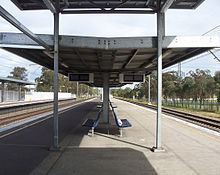
Glenfield railway station is a major interchange station for South-West Sydney. It is the junction for the Revesby and Granville branches of the Airport, Inner West & South Line on the Sydney Trains network. The station received a major upgrade as part of the South West Rail Link, including construction of an overhead concourse, multi-storey car park, new, fourth platform and conversion of a terminating platform to a through platform. The new railway line west to Leppington opened on 8 February 2015, meaning trains now serve Glenfield from the north, south, east and west.
The M5 South Western Motorway and Hume Highway sit on the western border of Glenfield. Additionally, the Westlink M7 is also close to its western border.
Schools
Sports grounds
Seddon Park - used primarily for Cricket and Rugby League. Blinman Park - used primarily for Cricket and Soccer Kennett Park - used for Baseball Glenfield Tennis Courts