
Country United States Incorporated March 29, 1935 Elevation 1,761 m Zip code 84729 Local time Tuesday 1:47 PM | Founded 1862 Time zone Mountain (MST) (UTC-7) Area 20.2 km² Population 377 (2013) Area code 435 | |
 | ||
Weather 22°C, Wind SW at 10 km/h, 17% Humidity | ||
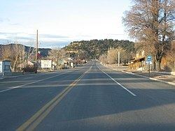
Glendale is a town in Kane County, Utah, United States. The population was 355 at the 2000 census. The town was named after Glendale, Scotland, the native home of a large share of the early settlers.
Contents
- Map of Glendale UT 84729 USA
- Geography
- Grand Staircase Escalante National Monument
- Demographics
- History
- References
Map of Glendale, UT 84729, USA
Geography
Glendale is located at an elevation of 5,800 feet (1,800 m) in Long Valley.
According to the United States Census Bureau, the town has a total area of 7.8 square miles (20.2 km²), all of it land.
Grand Staircase-Escalante National Monument
An entrance to the Grand Staircase-Escalante National Monument (GSENM) is right in the center of town in Glendale. The rustic and scenic Bench Road meets with Skutumpah Road, running through the GSENM and ending at one of the GSENM Visitor Centers in Cannonville, near Bryce Canyon.
Demographics
As of the census of 2000, there were 355 people, 116 households, and 88 families residing in the town. The population density was 45.5 people per square mile (17.6/km²). There were 149 housing units at an average density of 19.1 per square mile (7.4/km²). The racial makeup of the town was 99.15% White, 0.56% Native American, and 0.28% from two or more races. Hispanic or Latino of any race were 3.94% of the population.
There were 116 households out of which 38.8% had children under the age of 18 living with them, 71.6% were married couples living together, 4.3% had a female householder with no husband present, and 23.3% were non-families. 20.7% of all households were made up of individuals and 9.5% had someone living alone who was 65 years of age or older. The average household size was 3.06 and the average family size was 3.62.
In the town, the population was spread out with 34.1% under the age of 18, 8.5% from 18 to 24, 21.1% from 25 to 44, 23.1% from 45 to 64, and 13.2% who were 65 years of age or older. The median age was 31 years. For every 100 females there were 107.6 males. For every 100 females age 18 and over, there were 101.7 males.
The median income for a household in the town was $35,938, and the median income for a family was $38,500. Males had a median income of $24,722 versus $20,000 for females. The per capita income for the town was $17,322. About 5.4% of families and 8.1% of the population were below the poverty line, including 15.0% of those under age 18 and none of those age 65 or over.
History
In 1862 ranchers came to Long Valley, land east of Zion National Park, to graze cattle along the East Fork of the Virgin River. Robert and Isabella Berry named the area now known as Glendale, Berryville. In 1866 after the Berry’s were killed by Indians, the other settlers left.
It was in 1871 that Mormons, from the Muddy River settlement in Nevada, came to settle naming the town Glendale. The people of St. Thomas, Nevada relocated en masse to Glendale in this year, preserving the old ward organization at the new location. By the 1800s the Mormon communities in the area had grown in the nearby towns of Orderville and Mt Carmel Junction., Glendale became part of the United Order. The United Order movement was a program of economic and moral reform that began in 1874 under Brigham Young. On March 29, 1935 Glendale became an incorporated town. The Towns of Mount Carmel, Orderville, and Glendale are known as Long Valley.