
Time zone CET/CEST (UTC+1/+2) Area 128.9 km² Local time Tuesday 6:52 PM | Elevation 185 m (607 ft) Postal codes 37130 Population 9,411 (31 Dec 2008) Postal code 37130 | |
 | ||
Weather 9°C, Wind W at 8 km/h, 75% Humidity | ||
Gleichen is a municipality (in this case, a Gemeinde) in the district of Göttingen, in Lower Saxony, Germany. Named after the two castles, Neuen-Gleichen and Alten-Gleichen on the twin peaks in the Gemeinde, it is situated about 10 km southeast of Göttingen, from which the peaks are visible. Its seat is Reinhausen.
Contents
- Map of Gleichen Germany
- Location
- Subdivisions
- Political situation
- Cultural resources and attractions
- References
Map of Gleichen, Germany
Location
The municipality of Gleichen is located southeast of Göttingen, west-southwest of Duderstadt and north-northwest of Heilbad Heiligenstadt. The River Garte flows through several of the villages in the municipality, as does the small Wendebach stream, which is impounded by the Wendebach Reservoir. Both streams are right, eastern tributaries of the Leine.
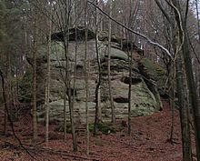
In the center of the municipality are Die Gleichen, a pair of hills 430 m high, that rise between Appenrode, Bettenrode and Gelliehausen. Both hills were once crowned by castles, whose ruins may still be seen.
The villages in the municipality may be accessed on state roads (Landesstraßen) branching eastwards off the B 27 federal road.
Subdivisions
Besides Reinhausen, the villages in the municipality are:
Political situation
Currently, the community council of twenty-five (including the mayor) has eleven SPD, six CDU, five Greens, two BsP, and one SWG members.
Cultural resources and attractions
The Akademie Waldschloesschen lies on the L568 between Reinhausen and Bremke. In Bremke itself, there is the Waldbühne, an outdoor stage where, since 1949, fairy tales have been presented in the form of plays.