
Country United States County Imperial County Local time Tuesday 6:41 AM | State California Elevation 102 m | |
 | ||
Weather 17°C, Wind N at 10 km/h, 35% Humidity | ||
Glamis is an unincorporated community in Imperial County, California. It is located 22 miles (35 km) northeast of Holtville, at an elevation of 335 feet (102 m).
Map of Glamis, CA 92227, USA
Glamis (GLA-MIS) also mispronounced as (GLE-MIS), is one of a series of former Southern Pacific railroad stops along the eastern edge of the Algodones Dunes, located where the railway crosses State Route 78; other former stops in this area include Acolita, Clyde, Ruthven and Ogilby.
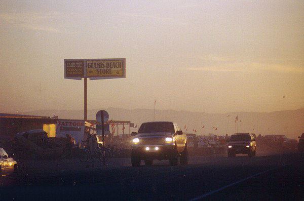
Glamis has virtually no permanent structures aside from the "Glamis Store" and "Boardmanville Trading Post". Both offer supplies; however, fuel is not available for some of the hundreds of thousands of recreational visitors each year (many of them ORV users) who pass through the Algodones Dunes and the associated Imperial Sand Dunes Recreation Area, located in the southern portion of the dune system. The name "Glamis" or "Glamis Dunes" is often used to refer to either or both of these areas, though technically this is incorrect.
Glamis's post office operated from 1886 to 1888, 1899 to 1901, 1917 to 1920, 1921 to 1923, and from 1940. Glamis's ZIP code is 92283.
Glamis is the closest community to the new Mesquite Regional Landfill, a waste-by-rail landfill being constructed for municipal trash primarily originating at the Puente Hills Intermodal Facility in Los Angeles County, and the Mesquite Mine, a gold mine.