
 | ||
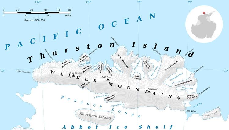
Glacier Bight is an open embayment about 22 nautical miles (40 km) wide, indenting the north coast of Thurston Island between Hughes Peninsula and Noville Peninsula. It was first delineated from air photos taken by U.S. Navy Operation Highjump in December 1946, and was named by the Advisory Committee on Antarctic Names for the icebreaker USS Glacier, the first ship ever to make its way to this coastal area, in February 1960.
Maps
References
Glacier Bight Wikipedia(Text) CC BY-SA