
Country United States FIPS code 05-26800 Elevation 181 m Zip code 72636 Local time Monday 5:57 PM | Time zone Central (CST) (UTC-6) GNIS feature ID 0049404 Area 80 ha Population 27 (2013) Area code 870 | |
 | ||
Weather 1°C, Wind NW at 16 km/h, 66% Humidity | ||
Gilbert is a town in Searcy County, Arkansas, United States. The population was 28 at the 2010 census, ranking it as one of the smallest municipalities in the state and nation. Over the years, Gilbert has gained a reputation (along with Calico Rock) as one of the coldest locations in Arkansas.
Contents
Map of Gilbert, AR, USA
History
The Gilbert General Store, built in 1901, is listed on the National Register of Historic Places under the name Mays Store. The community was founded in 1902 when a railroad construction camp for the Missouri and North Arkansas Railroad was built and named in honor of Charles W. Gilbert, secretary-treasurer of Allegheny Supply Company, which was building the railroad. In 1906, William Mays moved his store and post office from Duff, located a few miles away.
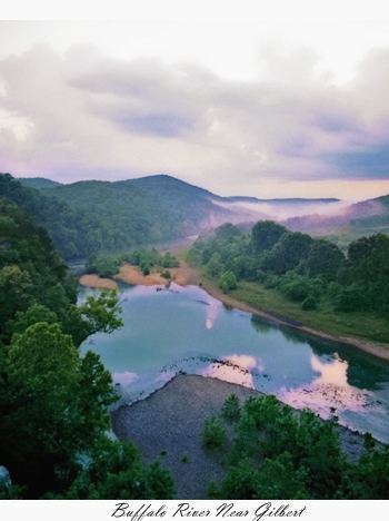
Gilbert was a hub for commerce. Cotton, logs, ore and grain came by rail. Gilbert was eventually the home to a repair shop for the railroad, which ceased operation in 1946. While the tracks were removed and sold as scrap, there are still signs of the railroad where the old concrete supports crossed the Buffalo River. The former rail bed is now a hiking route along the river.
Today, Gilbert contains a few homes, guest houses and cabins for rent, and camping facilities. The Gilbert General Store is still in operation, providing supplies and hunting and fishing licenses. The Gilbert Café serves diners in the area. Remnants of old homesteads provide a hint of its past.
Geography
According to the United States Census Bureau, the town has a total area of 0.8 km² (0.3 mi²).
Major highways
School District
Gilbert is in the Ozark Mountain School District, with a K-12 campus in nearby St. Joe.
Demographics
As of the census of 2000, there were 33 people, 18 households, and 10 families residing in the town. The population density was 41.1/km² (105.1/mi²). There were 29 housing units at an average density of 36.1/km² (92.4/mi²). The racial makeup of the town was 100.00% White.
There were 18 households out of which 11.1% had children under the age of 18 living with them, 44.4% were married couples living together, 11.1% had a female householder with no husband present, and 44.4% were non-families. 33.3% of all households were made up of individuals and 11.1% had someone living alone who was 65 years of age or older. The average household size was 1.83 and the average family size was 2.30.
In the town, the population was spread out with 9.1% under the age of 18, 6.1% from 18 to 24, 18.2% from 25 to 44, 45.5% from 45 to 64, and 21.2% who were 65 years of age or older. The median age was 50 years. For every female resident, there were 1.063 males. For every female resident age 18 and over, there were 1.143 males.
The median income for a household in the town was $18,750, and the median income for a family was $20,625. Males had a median income of $28,750 versus $26,250 for females. The per capita income for the town was $15,729. There were no families and 17.1% of the population living below the poverty line, including none under the age of 18 and none of those over 64.
Climate
The climate in this area is characterized by hot, humid summers and generally mild to cool winters. According to the Köppen Climate Classification system, Gilbert has a humid subtropical climate, abbreviated "Cfa" on climate maps.