
 | ||
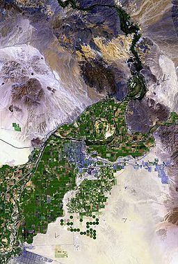
The Gila Valley of Yuma County, Arizona is a small valley surrounding the Gila River at its confluence with the Colorado River, the Colorado being the border between California and Arizona, and locally southwest of Yuma – Baja California, and Sonora states, Mexico.
Contents
The valley extends only 10 miles (16 km) from its confluence to the northern end of the Gila Mountains, which abut the east end of the Laguna Mountains, where the Gila River meanders, west, southwest, then due west again.
Description
The Gila Valley is called the North Gila Valley in the northern parts, north of the Gila River, and it is called the South Gila Valley in the south. The communities in the valley are agricultural, especially in the south and southwest, towards Yuma, Arizona.
The South Gila Valley borders the Yuma Mesa on its south, where the Fortuna Foothills are located on the northwest perimeter of the Gila Mountains.
Recreational use
The North Gila Valley contains the Adair Range, a shooting range located on the southern edge of the Laguna Mountains.