
Location Pacific Ocean Width 5 km (3.1 mi) Elevation 180 m | Length 11 km (6.8 mi) Highest elevation 180 m (590 ft) | |
 | ||
Island groups | ||
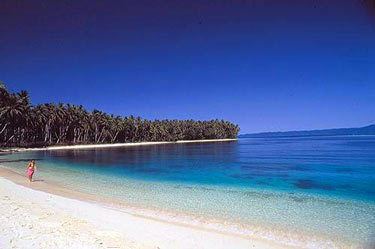
Ghizo Island, home to Gizo, the capital of the Western Province, Solomon Islands. The island is named after an infamous local head-hunter. It is located west of New Georgia and Kolombangara. Ghizo is home to a substantial number of people of I-Kiribati descent. These people were relocated there by the British administration of the British Solomon Islands Protectorate (now simply referred to as the Solomon Islands)in the 1950s. They had previously spent 20 years on the islands of Orona (Hull Island) and Nikumaroro (Gardener Island), having been resettled on these previously uninhabited islands in the Phoenix Group from various islands in the Gilberts archipelago in the 1930s. The original resettlement in the 1930s was on alleged grounds of overcrowding, particularly on drought prone islands in the southern Gilberts. The second resettlement was on alleged grounds of the islands in the Phoenix group having harsh living conditions and also prone to drought, although remoteness and costs falling on the colonial administration also played parts. See also Wagina Island.
Map of Ghizo Island, Solomon Islands
Ghizo is relatively small when compared to the surrounding islands, the island is 11 kilometres (6.8 mi) long and 5 kilometres (3.1 mi) wide, with a summit elevation of 180 metres (590 ft) (Maringe Hill).