Country United States County Wichita | State Texas Elevation 289 m | |
 | ||
Area 183.1 km² (183 km² Land / 10 ha Water) | ||
Exposed RocksEdit
The exposed strata at the surface in and around Wichita Falls are the products of one ancient period of deposition with a modest amount of recent and modern alteration. In all cases, the strata are products of terrigenous (non-marine) environments dominated by fluvial depositional and erosional systems (rivers and streams).
Contents
- Exposed RocksEdit
- Brief geologic historyEdit
- Permian RocksEdit
- Pleistocene andor early Holocene SedimentsEdit
- Holocene SedimentsEdit
- Structural GeologyEdit
- References
Brief geologic historyEdit
The rocks found in and around Wichita Falls result from southwesterly-flowing Permian streams that deposited sands in channels and silts and clays on the surrounding floodplains. Calcium-carbonate rich soils concurrently developed adjacent to these streams. These were likely buried by further Permian sedimentation and then lithified. Pleistocene erosion removed the younger rocks, exposing the current strata. Exposures of sediments indicate that northeast-flowing streams locally deposited silts, clays, sands, and some gravels on the Permian rocks. These are subsequently modified by modern (Holocene) stream erosion and deposition.
Permian RocksEdit
In the Permian geologic period, North-Central Texas was a part of the western coastal zone of equatorial Pangea, a super-continental land mass. Nearby uplifts and mountainous regions, such as the Muenster Arch and Red River Uplift, the Wichita, Arubckle, and Ouachita mountains developed by the end of the Pennsylvanian, providing elevated topography to the north and east during the Permian. The rocks of the Permian Basin of West Texas record a contemporaneous shallow inland sea. The resulting topography provided northeast-to-southwest gradients for stream flow and sediment movement. The sediments deposited by the Permian streams of North-Central Texas were likely reworked clastic materials from Middle Pennsylvanian stream and fan-delta sediments proximal to the Ouachita foldbelt and Muenster Highlands.
The Petrolia Formation (of the Late Wolfcampian-Leonardian systems) dominates the exposed Permian strata in Wichita falls, as mapped by the 1987 Texas Atlas of Geology. The map describes the formation as 360–400 feet of weakly or unstratified mudstone with laminated, cross-bedded sandstone lenses. The formation increases in mudstone content upsection. Sandstone lenses contain terrestrial fossils of plants, vertebrates, and footprints. The unit contains calcareous nodules of varying sizes as well as poorly indurated "conglomerate" with vertebrate fossils. In general the entire package is only weakly lithified, perhaps indicating that the region was not appreciably covered by a thick package of younger strata.
Several correlated sandstone units crop out in the immediate region. These dominate the region adjacent to the Seymour Highway, on the slopes to the south of the Wichita River (locally known as "the bluffs"). The Texas Atlas of Geology mapped these as ss6. Most outcrops are buff colored medium-grained, well-sorted quartzose sandstones. These exhibit extensive cross-bedding and soft-sediment deformation features. Some deposits are friable, others well cemented. Locally, there appears to be three prominent layers of sandstone separated by mudstone. Because of variable erosion rates, each influences topography by forming ledges and benches, and in places may form mesa-like landforms. In and around the city, these occur roughly at 960, 1000, and 1060 feet above sea level.
Pleistocene and/or early Holocene SedimentsEdit
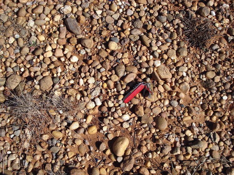
Up to 30 feet of fluvial deposits of unconsolidated gravel, sand, and silt mapped as terrace deposition by the 1987 Texas Atlas of Geology. Gravels are granule-to-cobble size, with clasts of angular to well-rounded quartzite, quartz, and chert from distal sources and lesser fragments of local strata. The sands are orange-brown to tan, fine- to coarse-grained with preserved soils.
Holocene SedimentsEdit
Up to 30 feet of floodplain and channel sand, silt, clay, and gravel from the modern stream systems. This includes terrace deposits near floodplain, colluvium on valley slopes, and local wind-blown sand and silt.
Structural GeologyEdit
The region is largely underlain with shallowly west-dipping strata, but a significant uplifted block is found in the subsurface immediately north of Wichita Falls. This block, locally known as the Red River uplift, may be part of an uplifted system that extends eastward, joining the Muenster Arch. The uplifts offset Pennsylvanian and older strata in the subsurface and are thought to be contemporaneous with the Ouachita and Ancestral Rocky Orogenies. These Pennsylvanian orogenies resulted from the closure of the Iapetus ocean as the Gondwana and Laurentia continents collided to form Pangea.
