
Country United States City St. Louis ZIP code(s) Part of 63104 Area 168 ha Area code 314 | State Missouri Wards 6, 19 Website stlouis-mo.gov Population 3,456 (2010) | |
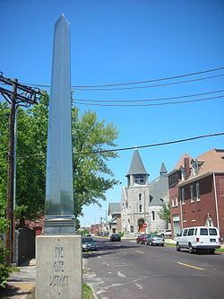 | ||
The Gate District is a neighborhood of St. Louis, Missouri. The Gate District is defined as the area between Chouteau Avenue and Interstate 44 on the north and south and between South Jefferson Avenue and South Grand Boulevard on the east and west. This area is just south of the central corridor and west of Lafayette Square.
Contents
Demographics
In 2010 The Gate District's racial makeup was 82.0% Black, 14.4% White, 0.2% Native American, 1.3% Asian, 1.4% Two or More Races, and 0.4% Some Other Race. 1.1% of the population was of Hispanic or Latino origin.
Neighborhoods
The Gate District is subdivided into four neighborhoods:
References
Gate District, St. Louis Wikipedia(Text) CC BY-SA