
Country Colombia Founded 5 October 1809 Time zone -5 Area 150 km² Local time Friday 6:35 AM | Department Boyacá Elevation 1,650 m (5,410 ft) Website Official website Population 16,944 (2015) Province Neira Province | |
 | ||
Weather 16°C, Wind N at 2 km/h, 85% Humidity | ||
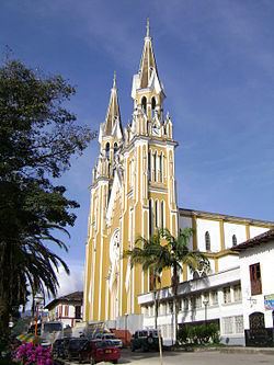
Garagoa ([ɡaɾaˈɣoa]) is a town and municipality in Colombia, located in the Boyacá Department. It covers an area of 191.75 km² and the urban centre is located at an altitude of 1,650 metres (5,410 ft) above sea level. Parts of the municipality reach altitudes of 3,050 metres (10,010 ft). It is the capital of the province of Neira. It is also the seat of the Diocese of Garagoa of the Catholic Church. The municipality is situated in the Eastern Ranges of the Colombian Andes and borders Chinavita in the north, Macanal in the south, Tenza and Sutatenza in the west and Miraflores and Chinavita in the east.
Contents
Map of Garagoa, Boyac%C3%A1, Colombia
Etymology
Garagoa in Chibcha means "Behind the hill" or "On the other side of the hill".
History
In the times before the Spanish conquest, the area of Garagoa was inhabited by the Muisca, organized in their loose Muisca Confederation. Garagoa was ruled by the zaque based in Hunza. Garagoa was visited by conquistador Gonzalo Jimenez de Quesada in 1539, and was elevated to municipal status on October 5, 1809.
Economy
Main economical activities of Garagoa are agriculture, livestock farming and mining. Among the agricultural products, most important are maize, yuca, potatoes, arracacha, bananas, peas, beans, pumpkins, tomatoes, fique, coffee and sugar cane. Also mangoes, chirimoya, oranges, avocadoes, pineapples, mandarines, papayas, maracuyá and guayaba are produced. Mining is mostly coal.