
Location Waikato Region Population 0 | Highest elevation 15 m (49 ft) Elevation 15 m | |
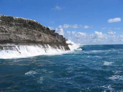 | ||
Gannet Island (Karewa in Māori) is a small island some 19 kilometres (12 miles) offshore from Kawhia on the west coast of New Zealand's North Island.
Contents
Map of Gannet Island, New Zealand
Description
The island consists of the eroded remnant of a tuff ring, erupted about half a million years ago. It is considerably younger than, and compositionally distinct from, the nearby onshore Alexandra Volcanics (Mount Karioi and Mount Pirongia) and Okete Volcanics. It is located on the eastern edge of the North Taranaki Graben, rising 15 metres (49 ft) above sea level from a base about 65 metres (213 ft) deep.
Gannets
Protected as a wildlife sanctuary, it was found to be the country's largest single breeding colony of Australasian gannets in a 1980 census. Holding about 8000 breeding pairs, the island has been identified as an Important Bird Area, by BirdLife International.