
Country United States ZIP code 36540 Local time Thursday 11:42 AM | Time zone Central (CST) (UTC-6) Area code(s) 251 | |
 | ||
Weather 22°C, Wind SW at 5 km/h, 46% Humidity | ||
Gainestown is an unincorporated community on the Alabama River in Clarke County, Alabama, United States. It was named for George Strother Gaines. Gaines established an Indian trading post here in 1809.
Contents
Map of Gainestown, AL 36540, USA
The exact date for the founding of the town is unclear. However, the community was being referred to as Gainestown by 1815, following the end of the Creek War and subsequent closure of the trading post in 1814. Gainestown grew to be a large town during the heyday of river-based transport, but a slow decline began after the American Civil War.
A tornado on March 26, 1911 destroyed at least 12 homes and much of the town. A contemporaneous account of the storm stated that a dry goods store at Gainestown was destroyed, with fragments of its products found as far away as 30 miles (48 km) to the east, in Monroe County.
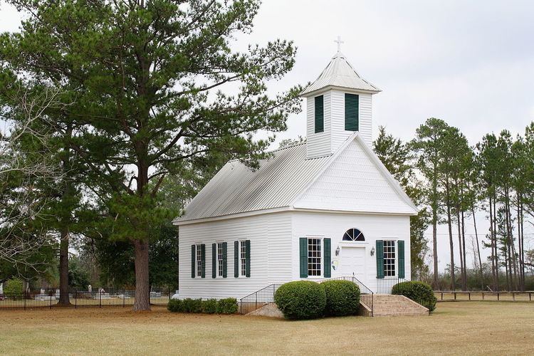
Gainestown has three sites on the National Register of Historic Places, the Gainestown Methodist Church and Cemetery, Gainestown Schoolhouse, and the Wilson-Finlay House.
Geography
Gainestown is located at 31.44544°N 87.69332°W / 31.44544; -87.69332 and has an elevation of 266 feet (81 m).