
Time zone CET/CEST (UTC+1/+2) Area 40.71 km² Population 661 (31 Dec 2008) Dialling code 05862 | Elevation 77 m (253 ft) Postal codes 29473 Local time Sunday 10:05 PM Postal code 29473 Municipal assoc. Elbtalaue | |
 | ||
Weather 3°C, Wind E at 8 km/h, 78% Humidity | ||
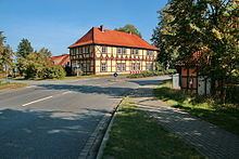
Göhrde is a municipality in the district of Lüchow-Dannenberg, in Lower Saxony, Germany.
Map of 29473 G%C3%B6hrde, Germany
The municipality was named after the Göhrde State Forest, which has an area of about 75 square kilometres (29 sq mi), famous for its oaks, beeches and game preserves. The hunting lodge situated in the forest was built in 1689 and was restored by Ernest Augustus, King of Hanover. It is known to history on account of the constitution of Gohrde, promulgated here in 1719.
It is also notable for the Battle of the Göhrde on 16 September 1813 during the War of the Sixth Coalition, in which Allied forces under Wallmoden defeated the French forces commanded by Pecheux.
This article incorporates text from a publication now in the public domain: Chisholm, Hugh, ed. (1911). "article name needed". Encyclopædia Britannica (11th ed.). Cambridge University Press.