
Parent range Krzeszowskie Wzgórza | Elevation 593 m | |
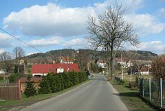 | ||
Góra Świętej Anny [ˈɡura ɕviɛ̃tɛj annɨ] (ger. Annen Berg, Annaberg) – peak 593 m a.s.l. in north-west part of band Krzeszowskie Wzgórza, in precinct Kotlina Kamiennogórska, in Central Sudetes.
Contents
Map of G%C3%B3ra %C5%9Aw. Anny, Poland
The geological structure
The summit is made up of Upper Cretaceous sandstones glauconite and mudstones. Below them, on the north side, arrears sandstones and conglomerates of rotliegend.
Vegetation
The apex as well as the majority of bands covered with pine forest, the undersigned, west stretch meadows.
Chapel of Saint Anne
Below the summit, on the western side of the Baroque chapel of St. Anna 1623. Destroyed in the second half of the twentieth century, the efforts of the inhabitants of Krzeszów was in the second decade of the twenty-first century rebuilt. Less than 3 chapels residues pilgrimage route from Krzeszów.