
Time zone CST (UTC+8) Subdivision 13 Villages Population 10,849 (Dec 2014) Province Taiwan Province | Region Eastern Taiwan Post code 983 Area 176.4 km² Local time Saturday 5:18 PM | |
 | ||
Weather 21°C, Wind S at 6 km/h, 85% Humidity | ||
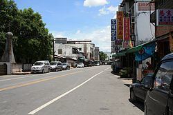
Fuli Township (Chinese: 富里鄉; pinyin: Fùlǐ Xiāng) is a rural township located in southern Hualien County, Taiwan.
Contents
- Map of Fuli Township Hualien County Taiwan 983
- Geography
- Administrative divisions
- Economy
- Tourist attractions
- Rail
- References
Map of Fuli Township, Hualien County, Taiwan 983
Geography
The township is located at the Huatung Valley. It has 10,849 inhabitants with 3,993 households around. The components of population are Hakka, Hoklo, and Ami people.
Administrative divisions
Wujiang Village, Tungli Village, Wanning Village, Xinxing Village, Zhutian Village, Luoshan Village, Shipai Village, Mingli Village, Fuli Village, Yongfeng Village, Fengnan Village, Funan Village, Xuetian Village.
Economy
The agricultural product of Fuli Rice is a famous rice in Taiwan and provides a well economy development and working chances for residents.
Tourist attractions
Rail
References
Fuli, Hualien Wikipedia(Text) CC BY-SA