
Gaelic name Fùideigh Area rank 101 | OS grid reference NF736082 Area 232 ha Lieutenancy area Outer Hebrides | |
 | ||
Highest elevation Mullach Neacail 89 metres (292 ft) Island groups British Isles, Outer Hebrides | ||
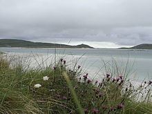
Fuday (Fuideigh) is an uninhabited island of about 232 hectares (0.90 square miles) in the Outer Hebrides of Scotland. It lies in the Sound of Barra, just east of Scurrival Point on Barra and west of Eriskay. Fuday is owned by the Scottish Government. Deserted since 1901, its peak population is recorded only as seven.
Map of Fuday, United Kingdom
It is still used for the summer grazing of cattle, and they used to be swum across the mile-wide, but shallow, Caolas Fuideach (strait) to there from Eoligarry. When cattle were first introduced to the island, they were killed by dehydration. The crofters who left the cattle on the island failed to show the animals the location of the only drinkable source of water on the island, a loch far inland on the island. The cattle thus could not find drinking water and died of thirst.