
Country United States Abandoned Late 1950s Local time Friday 9:09 PM | Founded 1950s Elevation 1,638 m | |
 | ||
Named for The canyon of the same name Weather 16°C, Wind E at 6 km/h, 26% Humidity | ||
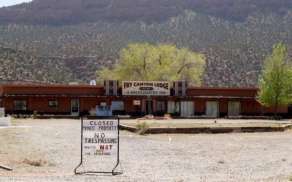
Fry Canyon was a small community in San Juan County, Utah, USA, located in Fry Canyon, just south of White Canyon, 50 miles west on State Route 95 from its junction with U.S. Route 191 at Blanding. Fry Canyon was a uranium boom town during the 1950s. The tiny hamlet, now a ghost town, is 19 miles west-southwest of Woodenshoe Butte, and 8 miles west-northwest of Natural Bridges National Monument.
Map of Fry Canyon, Utah 84533, USA
The activities of a uranium ore upgrader mill (1957-1960) and a subsequent copper heap leach operation (1963-1968) at Fry Spring, two miles southeast of Fry Canyon, caused uranium, copper and radium contamination of groundwater in colluvial channel deposits within Fry Creek. The U.S. Geological Survey (with funding from the U.S. Environmental Protection Agency, and other agencies) installed three permeable reactive barriers, containing three different reactive materials (foamed zero-valent iron (ZVI) pellets, bone charcoal pellets, amorphous ferric oxyhydroxide (AFO) slurry mixed with pea gravel), at the site, which is managed by the U.S. Bureau of Land Management.