
Country United States Abandoned 1929 Elevation 1,957 m | Established 1879 GNIS feature ID 1437563 Local time Friday 2:24 PM | |
 | ||
Weather 21°C, Wind S at 13 km/h, 16% Humidity Named for San Francisco Mountains (Utah) | ||
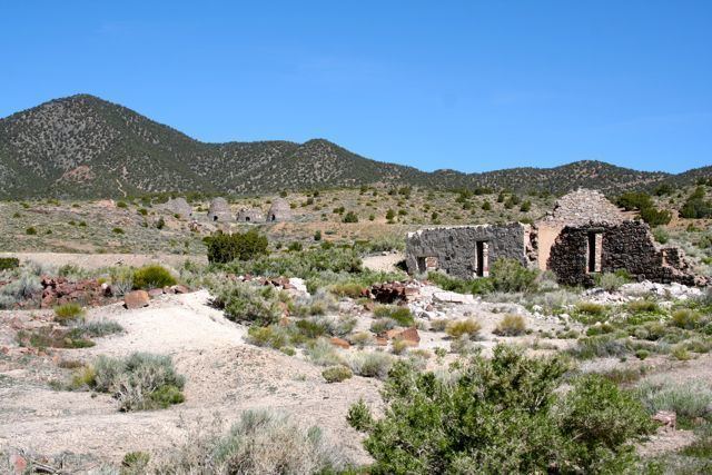
Frisco is a ghost town in Beaver County, Utah, USA. It was an active mining camp from 1879 to 1929. At its peak in 1885, Frisco was a thriving town of 6,000 people.
Contents
Map of Frisco, UT, USA
History
Frisco developed as the post office and commercial center for the San Francisco Mining District, and was the terminus of the Utah Southern Railroad extension from Milford. The Horn Silver Mine was discovered in 1875, and had produced $20,267,078 worth of ore by 1910. By 1885, over $60,000,000 worth of zinc, copper, lead, silver, and gold had been transported from Frisco from the many mines in the area.
With 23 saloons, Frisco was known as the wildest town in the Great Basin. Murder was common, and drinking water had to be freighted in.
Frisco's fortunes changed suddenly on February 13, 1885, when the Horn Silver Mine caved in completely. It was an unconventional mine, an open pit 900 feet (270 m) deep braced with timbers, and could have collapsed at any time.
In 1905 a Latter Day Saint ward was organized, but in 1911, with the closing of many of the mines, so many church members had left that the ward was discontinued. After many years of desertion, another company made an attempt to mine here in 2002.
Geography
Frisco is located at 38°27′35″N 113°15′32″W. Its elevation is 6,500 feet (2,000 m).
Demographics
The peak population was nearly 6,000.