
- land 0.19 sq mi (0 km) - summer (DST) CDT (UTC-5) Area code 504 | - water 0.00 sq mi (0 km), 0% Area 49 ha | |
 | ||
Restaurants Wayfare, Midway Pizza, Bar Frances, The High Hat Cafe, Liberty Cheesest | ||
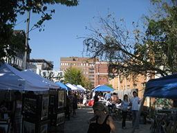
Freret is a neighborhood of the city of New Orleans. A subdistrict of the Uptown/Carrollton Area, its boundaries as defined by the City Planning Commission are: South Claiborne Avenue to the north, Napoleon Avenue to the east, LaSalle Street to the south and Jefferson Avenue to the west.
Contents
Map of Freret, New Orleans, LA, USA
Geography
Freret is located at 29°56′15″N 90°06′25″W and has an elevation of 0 feet (0.0 m). According to the United States Census Bureau, the district has a total area of 0.19 square miles (0.5 km2). 0.19 square miles (0.5 km2) of which is land and 0.00 square miles (0.0 km2) (0.0%) of which is water.
Adjacent Neighborhoods
Boundaries
The City Planning Commission defines the boundaries of Freret as these streets: South Claiborne Avenue, Napoleon Avenue, Danneel Street and Jefferson Avenue.
Demographics
As of the census of 2010, there were 1,715 people, 648 households, and 363 family households.