
Airport type Public Elevation AMSL 21 ft / 6.4 m 3,240 988 Phone +1 916-875-9035 | 18/36 3,240 Elevation 6.4 m | |
 | ||
Address 12480 Bruceville Rd, Elk Grove, CA 95757, USA Similar Sacrame Executive Airport, Lodi Airport Cafe, Rio Vista Muni, Kingdon Airpark Airport, Sacrame County | ||
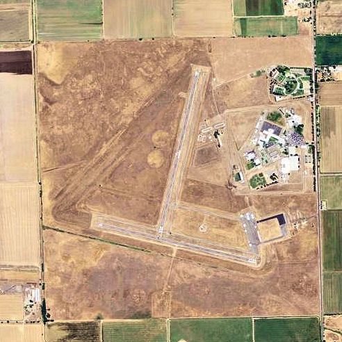
Franklin Field (FAA LID: F72), formerly Q53, is a public airport located four miles (6 km) southeast of the central business district (CBD) of Franklin in Sacramento County, California, USA. It is mostly used for general aviation. The airport was used for bomber training during World War II and in 1947 it was acquired by the County of Sacramento.
Contents
Facilities
Franklin Field covers 496 acres (201 ha) and has two runways:
World War II
During World War II, the airport was designated as Franklin Air Force Auxiliary Field, and was an auxiliary training airfield for both Mather Army Airfield and Stockton Army Airfield, California.
References
Franklin Field (California) Wikipedia(Text) CC BY-SA