
Country United States County Fairfax ZIP code 20171 Area 12.38 km² Population 19,288 (2010) | State Virginia Time zone Eastern (EST) (UTC-5) FIPS code 51-29628 Elevation 114 m | |
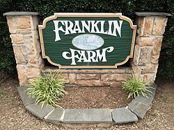 | ||
Franklin Farm refers to both a census-designated place (CDP) and a planned community located within the Oak Hill section of Fairfax County, Virginia, United States. It is a suburb of Washington, D.C., located about 20 miles west of the White House.
The Franklin Farm CDP, which was named for the older planned community contained within, had a population of 19,288 as of the 2010 census. The population was divided among 6,197 housing units, which were spread across 4.78 square miles (3,059 acres) of land.
The planned community of Franklin Farm is located within the CDP. Covering slightly less than 30 percent of the CDP, the planned community occupies 1.32 square miles (850 acres) and contains 1,777 housing units. It was established in 1980 and features 13 miles of trails, 6 fishing ponds, 6 tennis courts, 2 swimming pools, 14 tot lots, 3 multipurpose courts, 1 sand volleyball court, and 180 acres of open space. The Fairfax County Parkway bisects the community. The Franklin Farm Foundation is the homeowner association with jurisdiction over the planned community.
As an unincorporated area, Franklin Farm's boundaries are not officially defined by either a municipal government or by the government of Fairfax County, though the Franklin Farm Foundation does have specific boundaries.