
Country United States County Hillsborough Time zone Eastern (UTC-5) Elevation 253 m Population 1,562 (2010) | Incorporated 1772 Area code(s) 603 Zip code 03043 Local time Wednesday 10:18 PM | |
 | ||
Weather -8°C, Wind W at 14 km/h, 63% Humidity | ||
211 bible hill road francestown new hampshire real estate homes
Francestown is a town in Hillsborough County, New Hampshire, United States. The population was 1,562 at the 2010 census.
Contents
- 211 bible hill road francestown new hampshire real estate homes
- Map of Francestown NH USA
- 126 main street francestown new hampshire real estate homes
- History
- Geography
- Demographics
- Notable people
- References
Map of Francestown, NH, USA
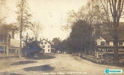
126 main street francestown new hampshire real estate homes
History
Incorporated in 1772, Francestown takes its name from Frances Deering Wentworth, the wife of colonial governor John Wentworth. There were 928 residents when the first census was taken in 1790. For some time the town used its location on the only route between Boston and Vermont, the Second New Hampshire Turnpike, to collect a toll of one cent per mile from coaches and wagons. High-quality soapstone was mined in Francestown until the 1890s.
Geography
According to the United States Census Bureau, the town has a total area of 30.7 square miles (80 km2), of which 30.2 square miles (78 km2) is land and 0.5 square miles (1.3 km2) is water, making up 1.73% of the town. The highest point in Francestown is the summit of Crotched Mountain, at 2,066 feet (630 m) above sea level, on the town's western border. Francestown lies fully within the Merrimack River watershed.
Demographics
As of the census of 2000, there were 1,480 people, 552 households, and 418 families residing in the town. The population density was 49.1 people per square mile (18.9/km²). There were 656 housing units at an average density of 21.7 per square mile (8.4/km²). The racial makeup of the town was 97.30% White, 0.07% African American, 0.34% Native American, 0.27% Asian, 0.47% from other races, and 1.55% from two or more races. Hispanic or Latino of any race were 0.54% of the population.
There were 552 households out of which 34.6% had children under the age of 18 living with them, 66.8% were married couples living together, 6.0% had a female householder with no husband present, and 24.1% were non-families. 17.0% of all households were made up of individuals and 6.3% had someone living alone who was 65 years of age or older. The average household size was 2.68 and the average family size was 3.04.
In the town, the population was spread out with 27.4% under the age of 18, 4.1% from 18 to 24, 28.7% from 25 to 44, 28.0% from 45 to 64, and 11.9% who were 65 years of age or older. The median age was 40 years. For every 100 females there were 103.9 males. For every 100 females age 18 and over, there were 99.8 males.
The median income for a household in the town was $64,259, and the median income for a family was $71,471. Males had a median income of $50,521 versus $32,778 for females. The per capita income for the town was $28,942. About 1.2% of families and 3.0% of the population were below the poverty line, including 2.5% of those under age 18 and 3.5% of those age 65 or over.