Country United States GNIS feature ID 1029039 Area 248 ha Area code 701 | Time zone Central (CST) (UTC-6) Elevation 504 m Population 75 (2010) | |
 | ||
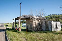
Foxholm is a census-designated place and unincorporated community in Ward County, North Dakota, United States. Its population was 75 as of the 2010 census.
Map of Foxholm, ND 58718, USA
Foxholm is located along U.S. Route 52, 18 miles (29 km) northwest of Minot and 76 miles (122 km) southeast of the Saskatchewan and North Dakota border at Portal, ND/North Portal, SK. Foxholm is in the Des Lacs River Valley.
A post office called Foxholm was established in 1894, and remained in operation until 1967. The community supposedly was named after a place in England.
References
Foxholm, North Dakota Wikipedia(Text) CC BY-SA
