
Length 110 km Mouth elevation 0 | ||
 | ||
Main source Monte Altieri840 m (2,760 ft) River mouth Adriatic near Lake Lesina0 m (0 ft) | ||
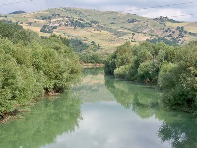
The Fortore (Latin: Fertor or Frento) is a river which flows through the provinces of Benevento, Campobasso and Foggia in southern Italy. It is 110 kilometres (68 mi) long.
Map of Fiume Fortore, Italy
The river rises from the slopes of Monte Altieri, which reaches 888 metres (2,913 ft) above sea level. The Fortore, on the Adriatic side of the Lucan Apennines, collects the waters of four small streams about 4 kilometres (2 mi) from San Bartolomeo in Galdo. From there it runs in a southerly direction through a narrow and twisting valley. After 22 kilometres (14 mi), near Castelvetere in Val Fortore, it exits from the province of Benevento. In its lower course it forms the border between the provinces of Campobasso and Foggia. The Fortore flows into the Adriatic Sea not far from Lake Lesina.