
 | ||
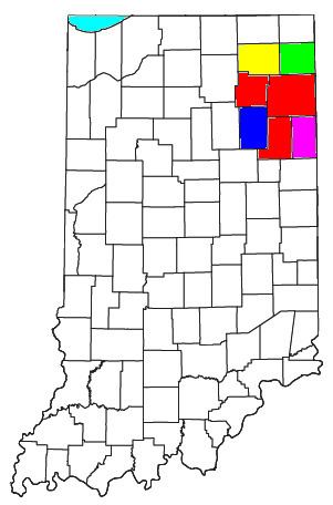
The Fort Wayne, IN Metropolitan Statistical Area is a federally designated metropolitan area consisting of three counties in northeastern Indiana (Allen, Wells, and Whitley counties), anchored by the city of Fort Wayne. As of the 2010 census, the MSA had a population of 416,257 (though a July 1, 2011 estimate placed the population at 419,453). The Fort Wayne metropolitan area is part of the Northern Indiana region, containing about 2.2 million people, and is considered part of the Great Lakes Megalopolis, which contains an estimated 59 million people.
Contents
Counties
Places with more than 100,000 inhabitants
Places with 10,000 to 100,000 inhabitants
Places with 1,000 to 10,000 inhabitants
Places with less than 1,000 inhabitants
Census-designated places (CDPs)
Combined Statistical Area
The Fort Wayne–Huntington–Auburn Combined Statistical Area (CSA) is made up of seven counties. The statistical area includes one metropolitan area and five micropolitan areas. As of the 2012 Census estimate, the CSA has a population of 616,785.