
Type Reservoir Primary outflows Wolf Creek Area 7.284 km² Shore length 41.8 km First flooded 1942 | Primary inflows Surface area 1,800 acres (730 ha) Surface elevation 732 m Year built 1938 | |
 | ||
Water volume 13,900 acre·ft (17.1 hm) Managing agency United States Army Corps of Engineers | ||
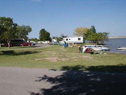
Fort Supply Lake is in Woodward County, Oklahoma, about 1 mile (1.6 km) south of Fort Supply and 12 miles (19 km) northwest of Woodward. Managed by the U.S. Army Corps of Engineers, the lake surface covers 1,800 acres (7.3 km2). There are about 6,000 acres (24 km2) of public hunting land managed by the Corps of Engineers and the Oklahoma Department of Wildlife Conservation adjacent to the lake.
Map of Fort Supply Reservoir, Oklahoma 73841, USA
The lake was created in 1942 by damming Wolf Creek, although the work actually began in 1938. The primary purposes of the lake are for flood control and conservational storage. Its normal elevation is 2,400 feet (730 m). The maximum volume of water is 13,900 acre feet (17,100,000 m3). The lake has 26 miles (42 km) of shoreline.
Recreational opportunities are readily available. Fishing is allowed and there are three handicap-accessible fishing piers in addition to shore fishing. Popular species include crappie, walleye, white bass, hybrid bass, channel catfish and flathead catfish.
The Corps of Engineers and the Oklahoma Department of Wildlife Conservation manage the adjacent hunting area. It is open year-round. Bobwhite quail and deer are the most popular species for hunters, but other species hunted include wild turkey, pheasant, dove, waterfowl, squirrel and rabbit.