
Founded 1971 Time zone AST (UTC-4) Area 26 km² Unemployment rate 16.1% (Apr 2015) | Demonym(s) Florideños Zip code 00650 Population 12,678 (2011) | |
 | ||
Florida ([floˈɾiða], Flowery) is a municipality of Puerto Rico located north of Ciales, south of Barceloneta, east of Arecibo, and west of Manatí. Florida is spread over one ward and Florida Pueblo (The downtown area and the administrative center of the city). It is part of the San Juan-Caguas-Guaynabo Metropolitan Statistical Area.
Contents
- Map of Florida Puerto Rico
- History
- Flag
- Coat of Arms
- Names
- Geography
- Barrios
- Tourism
- Economy
- Demographics
- Government
- Education
- Transportation
- Mayors of Florida
- Notable Floridians
- References
Map of Florida, Puerto Rico
History
Florida was founded first as a barrio of Barceloneta in 1881 when a priest, Father Carrión, the mayor of Barceloneta, and other dignitaries arrived at a terrain of almost 4 acres. They decided to establish a new barrio and the owner of the place, Don Manuel Cintrón granted the land while he retained a piece of it. The barrio was first called "Florida Adentro".
During the 20th century, several efforts were made to declare Florida as a municipality. First, on April 14, 1949, House Representative Francisco Díaz Marchand presented a project to create a legislative commission that would study the economic and social conditions of the barrio, to determine the suitability of it as an independent municipality. The project was unsuccessful. On 1960, Manuel Frías Morales presented a law that would permit the study to establish the municipality but it didn't succeed either.
Finally, on June 14, 1971, the Senate of Puerto Rico and Governor Don Luis A. Ferré approved the law that officially created the municipality of Florida. It is thus the youngest municipality established in the island.
Flag
It consists of three horizontal stripes, with the following colors and widths: green the superior and white the inferior, with five modules of width each one, the center one red, with a width of one module.
Coat of Arms
Field of silver, in an abyss, a gules (red) anchored cross, like the one in the Asturian district of Llanes. The cross is anchored between two branches of bloomed poinsettias (Poinsettia Pulcherrima). A green terrace represents the hilly terrain of the town, with a stripe forming waves outlined in silver which represents the underground river of Encantado. At the top, a three tower gold crown distinct in municipalities coat of arms. The shield can be surrounded, to its flanks and bottom by two crossed coffee tree branches with fruits.
Names
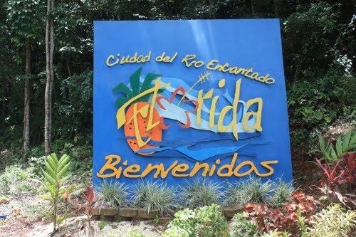
Florida derives its name from the abundant flowers and natural resources on its land. It is also known as "La Tierra del Río Encantado" due to an underground river called Encantado. Another nickname is the "Pueblo de la Piña Cayenalisa" due to its pineapple crops.
Geography
Florida is the second smallest municipality of Puerto Rico, with an area of 10 square miles. The municipality belongs to the coastal plains of the north of Puerto Rico and it's surrounded by small hills. Several caves are formed in the town like Román Cave, Miró Cave, and Juana Gómez Cave.
Barrios
The town of Florida is divided itself into several barrios or districts:
Tourism
Economy
Florida's economy has mostly relied on agriculture, specifically pineapple crops and other fruit related products. In recent years, there has been a spurt of manufacturing plants establishing in the area, some of them dedicated to plastics.
Demographics
Florida is one of the least populated municipalities of Puerto Rico, perhaps due to its small size. The population, according to the 2000 census, was 12,237 with a population density of 1,236.7 people per square mile (475.6/km²). However, according to the 1970 census when the town wasn't founded yet, there was‹See TfD› only one person living in the region. After its establishment in 1974, the population has steadily increased over the years, with only 7,232 people in the 1980 census.
Statistics taken from the 2000 census shows that 86.0% of Florideños are of White origin, 4.9% are black, 0.2% are Amerindian etc.
Government
After its initial establishment, Florida belonged to the Barceloneta region. In 1949 and 1960 there were some attempts to separate the barrio from Barceloneta, but these were unsuccessful. However, on 1974, Governor Luis A. Ferré and the Puerto Rican Senate officially declared Florida an independent municipality. Its first mayor was Jorge L. Pérez Piñeiro. The current mayor is José Gerena Polanco, of the New Progressive Party (PNP). He was elected at the 2012 general elections.
The city belongs to the Puerto Rico Senatorial district III, which is represented by two Senators. In 2008, José Emilio González and Angel Martínez were elected as District Senators.
Education
Florida counts with several public and private schools distributed through several regions. Public education is handled by the Puerto Rico Department of Education.
Transportation
Puerto Rico Highway 22 provides access to Road #140, which leads to Florida from the cities of Mayagüez in the west, or San Juan in the north.
Like most other towns in the island, it counts with a public transportation system consisting of public cars. Taxis are also available around the town.