
Area codes 061 Local time Monday 1:04 PM Area code 061 | Postal codes 6820-6824 Website www.florenville.be | |
 | ||
Weather 13°C, Wind NW at 10 km/h, 48% Humidity Governing parties Centre démocrate humaniste, Parti Socialiste | ||
Florenville is a Walloon municipality located in the Belgian province of Luxembourg. On 1 January 2016 the municipality had 5,639 inhabitants. The total area is 146.91 km², giving a population density of 38.38 inhabitants per km².
Map of Florenville, Belgium
It is located on the Semois River, facing the French border.
The municipality consists of the following sub-municipalities: Florenville proper, Chassepierre, Fontenoille, Lacuisine, Muno, Sainte-Cécile, and Villers-devant-Orval. Other population centers include: Azy, Conques, Laiche, Martué, Lambermont, Le Menil, and Watrinsart.
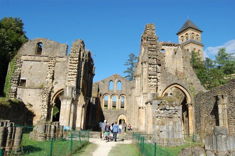
Orval Abbey is located in Villers-devant-Orval.
References
Florenville Wikipedia(Text) CC BY-SA