
Gaelic name Flodaigh Area rank 124= Lieutenancy area Outer Hebrides | OS grid reference NF846553 Highest elevation 20 m Area 145 ha Council area Outer Hebrides | |
 | ||
Meaning of name "Float island", from Norse | ||
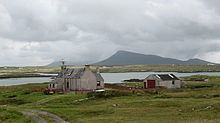
Flodaigh is a tidal island lying to the north of Benbecula and south of Grimsay in the Outer Hebrides, Scotland. It is connected to Benbecula by a causeway.
Map of Flodaigh, Isle of Benbecula, UK
The island is 145 hectares and in 2001 had a population of 11 and 7 in 2011. The census refers to the island by its anglicized name of 'Flodda'.
References
Flodaigh Wikipedia(Text) CC BY-SA