
Area rank 23rd of 105 Lowest elevation 208 m (682 ft) Area 30.17 km² Lau 2 07003 | Canton Grevenmacher Highest elevation 387 m (1,270 ft) Time zone CET (UTC+1) Local time Monday 5:25 AM | |
 | ||
Weather 3°C, Wind N at 10 km/h, 78% Humidity | ||
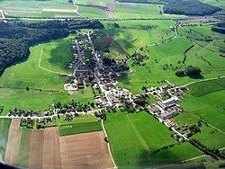
Flaxweiler (Luxembourgish: Fluessweiler) is a commune and small town in south-eastern Luxembourg. It is part of the canton of Grevenmacher, which is part of the district of Grevenmacher.
Map of Flaxweiler, Luxembourg
As of 2001, the town of Flaxweiler, which lies in the north-west of the commune, has a population of 338. Other towns within the commune include Beyren, Gostingen, Niederdonven, and Oberdonven.
The Mayor of Flaxweiler is the chief executive of the administration of the Luxembourgish commune of Flaxweiler. The incumbent mayor is Théo Weirich.
References
Flaxweiler Wikipedia(Text) CC BY-SA