
Country Australia Length 733 km Basin area 93,829 km² | Discharge 84.78 m³/s Source King Leopold Ranges | |
 | ||
Main source King Leopold Ranges486 metres (1,594 ft) Basin size 93,829 square kilometres (36,228 sq mi) | ||
The Fitzroy River is located in the West Kimberley region of Western Australia. Also known to the native Aboriginal people as Raparapa. Raparapa also translates to 'alongside the river' in the local language of Nyikina (Kimberley Region).
Contents
History
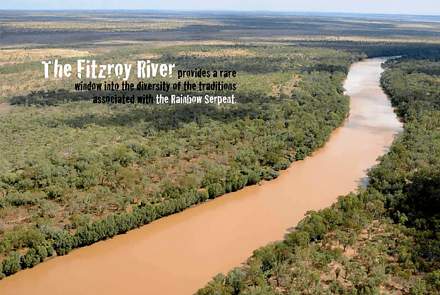
The first people to discover the river were the traditional owners of the areas around the river, including the Nyikina peoples to the west, the Walmadjari and Konejandi peoples to the east, who have lived in the area for at least 40,000 years. The local peoples know the area as Mardoowarra, the river and its vast floodplains are of great spiritual, cultural, medicinal and ecological significance.
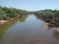
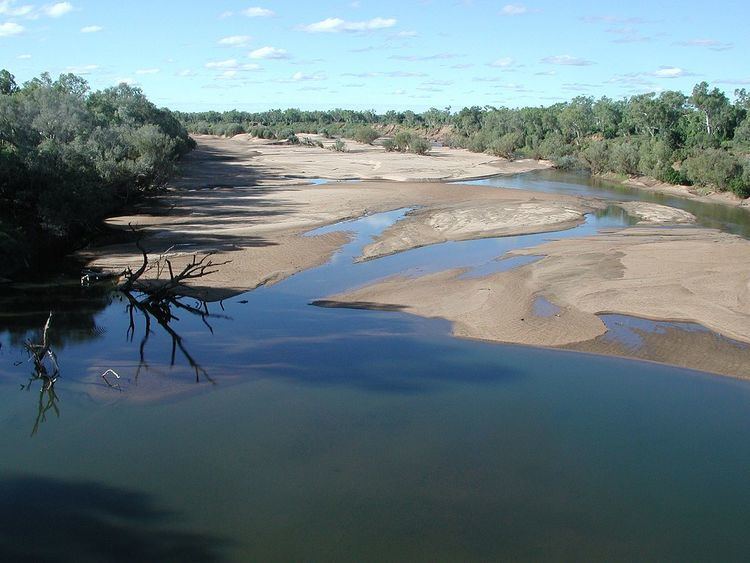
The first European to visit the Fitzroy River was George Grey in 1837 aboard the H.M.S. Beagle. The river was subsequently given its European name by Lieutenant J.L. Stokes in February 1838 after Captain Robert FitzRoy R.N. The Fitzroy River flows for 733 kilometres (455 mi) from the King Leopold and Mueller Ranges into King Sound south of Derby, and has a catchment area of 93,829 square kilometres (36,228 sq mi)
The first settlement that appeared along the river was Yeeda Station settled in 1880. The initial owners of the station were the Murray Squatting Company composed of William Paterson, George Paterson, Hamlet Cornish and Alexander Richardson. The company took up the property in the newly opened West Kimberley in 1880 and established the station with both cattle and sheep.
Other stations were established along the river further upstream during the 1880s including Noonkanbah Station, Gogo Station, Fossil Downs Station, Liveringa and Lower Liveringa Station.
Physiography
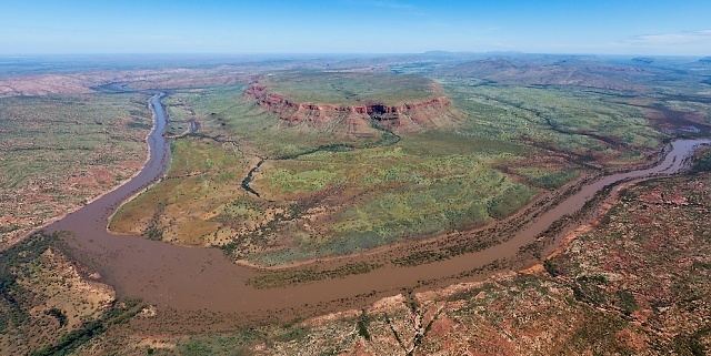
The surrounding area is also known as the Fitzroy Valley and is a distinct physiographic section of the larger Canning Basin province, which in turn is part of the larger West Australian Shield division.
Tributaries
The Fitzroy has 20 tributaries including Margaret River, Christmas Creek, Hann River, Sandy Creek, Geegully Creek, Little Fitzroy River, Collis Creek, Adcock River, Cunninghame River, Yeeda River, Mudjalla Gully and Minnie River.
Flooding
Extensive flooding during the wet season created a need for an adequate crossing. It was because of this that the town of Fitzroy Crossing was founded.
Flooding occurred along the river six times from 1892 to 1903. The 1903 flood washed away telegraph lines and great numbers of cattle and sheep were drowned, with bodies of animals later found hanging in trees. The heavy rains experienced in the area were the remnants of a cyclone.
In 1935, the Fitzroy got its first bridge – a low-level concrete structure, which was built up into a wider structure in 1958. This bridge could be closed for several months at a time during the wet weather and travellers were then forced to use a flying fox, which operated about 200 metres south of the crossing. When a new bridge was erected in 1974, the focus of the town grew away from its original site. The current town of Fitzroy Crossing is one of the fastest growing in the Kimberley region. Over 80% of its population consists of Aboriginals.
The river flooded after heavy rain events in 1949 and 1954. The 1954 event came immediately after a drought and the swollen river washed away stock from both Noonkanbah and Liveringa Station. At the height of the flood the river level was 10 feet (3 m) above the low level crossing. The mouth of the river was estimated at being over 7 miles (11 km) wide as it discharged the floodwaters.
Record floods occurred in 1983, 1986 and 2002 with approximately 13 metres of water over the old concrete crossing. The flow rate down the 15 km-wide flood plain at Fitzroy Crossing was estimated to be 30,000 cubic metres per second. In flood, it is probably the largest river in Australia.
Damming of the Fitzroy
The Fitzroy River was diverted in the 1950s as part of the failed Camballin Irrigation Scheme to store the water to irrigate crops of cotton, sorghum and other feed crops.
This part of the river covers an area of 12ha when full.
There have been other proposals over time to dam the river at Dimond Gorge.
In April 2007, the then state opposition leader Colin Barnett announced plans to dam the river, should he become elected, in order to provide a water source for a new irrigation venture to replace the Murray-Darling Basin which has experienced significant water shortages as a result of the drought. His 20-year plan also included piping the water further south as an additional source for the Perth Integrated Water Supply Scheme. However, these ventures were not pursued when in government.
Catchment area
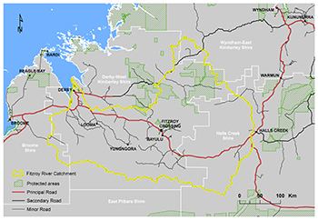
The catchment area occupies an area of 93,829 square kilometres (36,228 sq mi) situated within the Canning Basin and the Timor Sea drainage division extending from Halls Creek and the King Leopold Ranges in the east through to Derby and King Sound to the west. Parts of three shires; Wyndham-East Kimberley, Halls Creek and Derby-West Kimberley are found within the catchment area. The two main population centres of Derby and Fitzroy Crossing and 57 smaller Aboriginal communities are also found in the watershed making it home to about 7,000 people of which 80% are Aboriginal. The catchment area of the Fitzroy river was in 2012 found to be extensively pegged by mineral exploration companies Most of the land is under pastoral lease holding with about 44 mostly cattle stations operating within the catchment area. Some of the properties include: Mount Elizabeth, Mount Barnett, Glenroy, Mornington Sanctuary, Bedford Downs, Ruby Plains and Springvale to the east. Noonkanbah, Cherrabun, Gogo, Louisa Downs, Fossil Downs and Leopold Downs and found in the central part. To the west are properties including Myroodah, Mount Anderson, Mowla Bluff, Yakka Munga and Yeeda Stations.