
Area 2,336 km² Population 3,856 (2013) | Seat Roby Website www.co.fisher.tx.us Founded 1876 Unemployment rate 3.2% (Apr 2015) University Central Nazarene College | |
 | ||
Rivers Double Mountain Fork Brazos River, Clear Fork | ||
Fisher County is a county located in the U.S. state of Texas. As of the 2010 census, its population was 3,974. The county seat is Roby. The county was created in 1876 and later organized in 1886. It is named for Samuel Rhoads Fisher, a signer of the Texas Declaration of Independence and a Secretary of the Navy of the Republic of Texas. Fisher County is one of 30 prohibition, or entirely dry, counties in Texas.
Contents
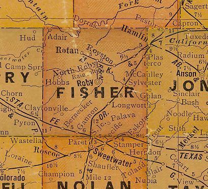
- Map of Fisher County TX USA
- History
- Geography
- Major highways
- Adjacent counties
- Demographics
- Cities
- Unincorporated communities
- Ghost Town
- References
Map of Fisher County, TX, USA
Republican Drew Springer, Jr., a businessman from Muenster in Cooke County, has since January 2013 represented Fisher County in the Texas House of Representatives.
From 1921 to 1925, the Democrat Richard M. Chitwood of Sweetwater represented Fisher County in the state House. He left his post to become the first business manager of Texas Tech University, but died the next year.
History
Geography
According to the U.S. Census Bureau, the county has a total area of 902 square miles (2,340 km2), of which 899 square miles (2,330 km2) is land and 2.8 square miles (7.3 km2) (0.3%) is covered by water.
Major highways
Adjacent counties
Demographics
As of the census of 2000, 4,344 people, 1,785 households, and 1,244 families resided in the county. The population density was five people per square mile (2/km²). The 2,277 housing units averaged two per square mile (1/km²). The racial makeup of the county was 83.75% White, 2.76% Black or African American, 0.37% Native American, 0.14% Asian, 11.58% from other races, and 1.40% from two or more races. About 21.36% of the population were Hispanic or Latino of any race.
Of the 1,785 households, 27.60% had children under the age of 18 living with them, 58.90% were married couples living together, 8.10% had a female householder with no husband present, and 30.30% were not families. About 28.30% of all households were made up of individuals, and 17.80% had someone living alone who was 65 years of age or older. The average household size was 2.39 and the average family size was 2.93.
In the county, the population was distributed as 23.90% under the age of 18, 6.30% from 18 to 24, 23.00% from 25 to 44, 24.10% from 45 to 64, and 22.70% who were 65 years of age or older. The median age was 43 years. For every 100 females, there were 92.90 males. For every 100 females age 18 and over, there were 89.80 males.
The median income for a household in the county was $27,659, and for a family was $34,907. Males had a median income of $25,071 versus $20,536 for females. The per capita income for the county was $15,120. About 13.50% of families and 17.50% of the population were below the poverty line, including 27.40% of those under age 18 and 10.50% of those age 65 or over.