
County Warren Named for Philip and John Fein Elevation 80 m Local time Saturday 5:52 PM | Time zone Eastern (EST) (UTC-5) Area 84 ha | |
 | ||
Weather -3°C, Wind W at 21 km/h, 40% Humidity | ||
Finesville is an unincorporated community and census-designated place (CDP) located within Pohatcong Township in Warren County, New Jersey, United States, that was defined as part of the 2010 United States Census. As of the 2010 Census, the CDP's population was 175.
Contents
- Map of Finesville Pohatcong NJ 08865 USA
- History
- Geography
- Census 2010
- Sites of interest
- Wineries
- References
Map of Finesville, Pohatcong, NJ 08865, USA
History
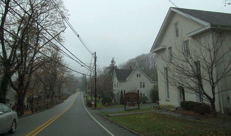
The community is located along the Musconetcong River between Pohatcong Mountain and Musconetcong Mountain, about a mile east of the Delaware River in a section of the Musconetcong Valley called the Musconetcong Gorge. The settlement was named for Philip and John Fein (often misspelled Fine by locals) who settled in the area from Germany. They built a dam and ran an oil mill, gristmill, sawmill, hotel and a store.
The area was first built up as a permanent settlement due to the construction of Chelsea Forge, built in 1751, a charcoal-iron forge on the Musconetcong. The forge helped to provide the Continental Army with weapons to defend Valley Forge. The Shank Brothers ran a ferry across the Delaware River from the point where the Musconetcong empties into it prior to 1800. The Fein gristmill burned and was later rebuilt as the Riegel Paper Corporation's paper mill and became the Taylor Stiles and Company knife factory. On October 7, 2009, the Finesville-Seigletown Historic District was listed on the New Jersey Register of Historic Places.
Geography
According to the United States Census Bureau, Finesville had a total area of 0.325 square miles (0.841 km2), all of which was land.
Census 2010
The 2010 United States Census counted 175 people, 72 households, and 49.03 families residing in the CDP. The population density was 538.8 per square mile (208.0/km2). The CDP contained 87 housing units at an average density of 267.9 per square mile (103.4/km2). The racial makeup of the CDP was 97.14% (170) White, 0.00% (0) Black or African American, 0.00% (0) Native American, 1.14% (2) Asian, 0.00% (0) Pacific Islander, 0.57% (1) from other races, and 1.14% (2) from two or more races. Hispanics or Latinos of any race were 2.86% (5) of the population.
Out of a total of 72 households, 31.9% had children under the age of 18 living with them, 59.7% were married couples living together, 5.6% had a female householder with no husband present, and 31.9% were non-families. 23.6% of all households were made up of individuals, and 5.6% had someone living alone who was 65 years of age or older. The average household size was 2.43 and the average family size was 2.88.
In the CDP, 22.9% of the population were under the age of 18, 4.0% from 18 to 24, 25.1% from 25 to 44, 38.3% from 45 to 64, and 9.7% who were 65 years of age or older. The median age was 43.5 years. For every 100 females the census counted 110.8 males, but for 100 females at least 18 years old, it was 110.9 males.