
 | ||
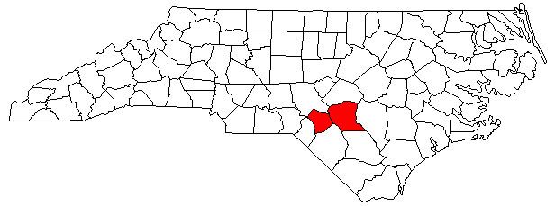
The Fayetteville Metropolitan Statistical Area, as defined by the United States Census Bureau, is an area consisting of two counties – Cumberland and Hoke – in eastern North Carolina, anchored by the city of Fayetteville.Its served with only one major Interstate which is Interstate 95 As of the 2000 census, the MSA had a population of 336,609 as of the 2010 census the MSA had a population of 366,383. In 2011 the estimated population was 374,157
Contents
Counties
Communities
Transportation
Demographics
As of the census of 2000, there were 336,609 people, 118,731 households, and 86,364 families residing within the MSA. The racial makeup of the MSA was 54.09% White, 35.17% African American, 2.54% Native American, 1.77% Asian, 0.28% Pacific Islander, 3.14% from other races, and 3.00% from two or more races. Hispanic or Latino of any race were 6.93% of the population.
The median income for a household in the MSA was $35,348, and the median income for a family was $38,785. Males had a median income of $28,117 versus $21,782 for females. The per capita income for the MSA was $15,506.