
Type Well Town or city Warsaw Completed 1787 Architectural style Classicism Architect Szymon Bogumił Zug | Address al. "Solidarności” Country Poland Opened 1787 Construction started 1783 | |
 | ||
Coordinates 52° 14′ 40″ N, 21° 0′ 6″ E Similar Blue Tower, Bank Square - Warsaw, Great Synagogue - Warsaw, Cathedral of St Mary Magdale, Evangelical Reformed Parish - W | ||
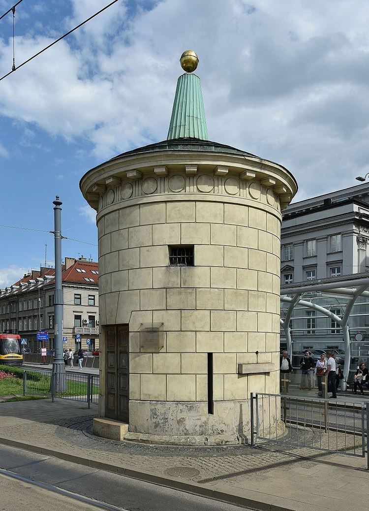
Fat Kaśka on Tłomackie is the popular name for a neoclassical well originating from the 18th century, located in Warsaw, at the middle of "Solidarności" Avenue close to the intersection with Generała Władysława Andersa Street.
Map of Gruba Ka%C5%9Bka, DW629, 01-001 Warszawa, Poland
It was built in 1787 and designed by Szymon Bogumił Zug at what was then Tłomackim Square, in the center of the Tłumackie jurydyka. The building has the shape of a cylinder. It is decorated with rusticated panels and has a stepped roof crowned with a gilded ball. The well was one of the few water wells built at that stage in Warsaw.
There was considerable fighting and destruction around it during World War II, notably during the Warsaw Uprising and the destruction of the adjacent Great Synagogue by the Germans in May, 1943. Immediately after the war, from 1947 to 1949, the road around it (then Leszno Street) was widening to create the major cross-street Trasa W-Z. Despite all this, the building remained almost unchanged.
A renovation in 2004 restored its original appearance, including exposing bricked up windows and strengthening its foundations.