
Location Farsi IslandIran Construction metal skeletal tower Characteristic Fl W 15s. Height 23 m | Foundation concrete basement Tower shape square pyramidal tower Focal height 28 m Range 29,632 m | |
 | ||
Markings / pattern white and black horizontal band tower | ||
Farsi Island (Persian: جزیره فارسی jazīreye fârsī) is a tiny, barren Iranian island in the Persian Gulf. There is an IRGC Navy base on this island. The island has an area of about 0.25 km2 (0.10 sq mi) and is restricted from the public. The center of Farsi Island is located at latitude 27° 59' 36" N and longitude 50° 10' 22" E. Its maximum elevation is 4 metres (13 ft). The word Farsi means "Persian".
Map of Farsi Island
In the late 1980s, during the "Tanker War" phase of the Iran-Iraq war, the IRGC used speedboats to launch attacks from Farsi Island on vessels of Iraq and its allies, including Kuwait. The United States entered the Persian gulf to protect Kuwaiti oil shipments. Iran planted naval mines near Farsi Island on the route of the very first convoy, consisted of US navy vessels escorting the Kuwaiti oil tanker Bridgeton, which hit one of the mines.
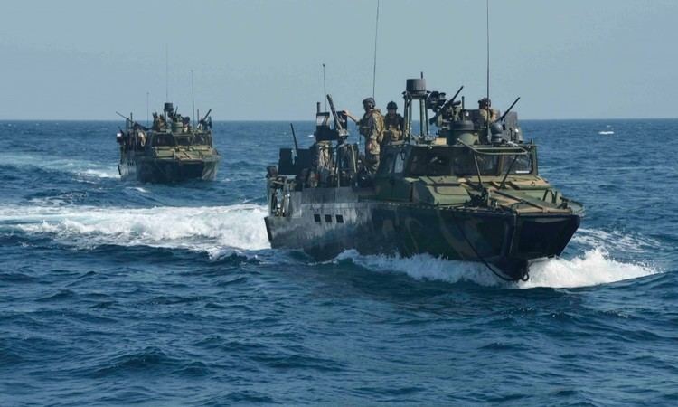
On January 12, 2016, Iranian Revolutionary Guards forces stationed at the island apprehended two small vessels and their 10 U.S. Navy sailors after the latter entered Iranian waters. The incident prompted talks between the Iranian Foreign Ministry and the U.S. State Department regarding their release. All 10 sailors and their vessels were released unharmed the following morning.