
 | ||
Restaurants Suika Japanese Restaurant, Heirloom Vegetarian Restaurant, Edible Canada, Kyo Korean BBQ & Su, The Sandbar Seafood Hotels Granville Island Hotel, Holiday Inn Vancouv (Broadway), Park Inn & Suites By Radisson, Plaza 500, Ramada Vancouver Centre | ||
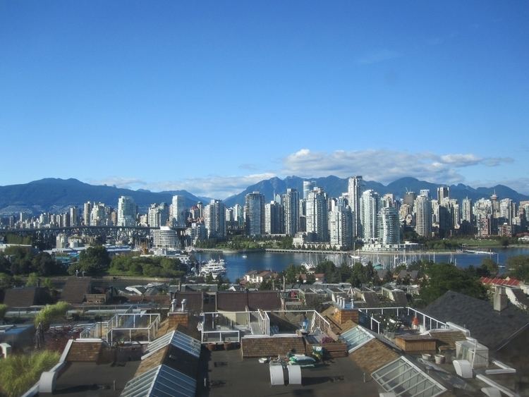
Fairview is a neighbourhood on the west side of the city of Vancouver, British Columbia, Canada. It runs from 16th Avenue in the south, to Burrard Street in the west, to Cambie Street in the east, and to False Creek in the north.
Contents
Map of Fairview, Vancouver, BC, Canada
Central Broadway is an important commercial and employment centre focused around Vancouver General Hospital and other health-related institutions, including the BC Cancer Agency, BC Cancer Research Centre, BC Healthy Living Alliance, and the BC Centre for Disease Control. Other shopping areas in the neighbourhood are South Granville Rise, City Square Mall, and Granville Island.
Some city offices are located on the eastern fringe of Fairview, across Cambie Street from Vancouver City Hall.
Education
Emily Carr University of Art and Design is found in the neighbourhood, on Granville Island.
Fairview is served by Kitsilano Secondary School and Eric Hamber Secondary School, as well as L'École Bilingue, Emily Carr Elementary School, Edith Cavell Elementary School, False Creek Elementary School, Henry Hudson Elementary School, Shaughnessy Elementary School, and Trafalgar Elementary School, although only False Creek and L'École Bilingue are physically located in the neighbourhood. The private schools Madrona School and Blessed Sacrament School also find their home in the neighbourhood.
History
The Fairview area, like nearly all of what is now the city of Vancouver, was a primeval rain forest rich with wildlife and gigantic timber until the opening of the Moodyville and Hastings Mills on Burrard Inlet in the 1860s and was one of the first areas to be logged. The area was one of the CPR land grants within the city but remained largely undeveloped until the city's expansion outside the Burrard Peninsula with the construction of the city's new electric railway system in the 1890s. Among the city's lines, which included the Cambie and Granville streetcars and the crosstown route along Broadway, a line known as the Fairview Loop ran in both directions from downtown up Main to Broadway to Granville and back into downtown. With that area's ease of access to the city core, commercial and residential development quickly filled out the neighbourhood, which north of Broadway enjoys a fine view of the city core and the North Shore Mountains, hence the name.
Demographics
As of 2006, Fairview has 29,295 people, a 3.1% increase from 2001. 9.3% of the population is under the age of 19; 42.7% is between 20 and 39; 34.6% is between 40 and 64; and 13.4% is 65 or older. 70.5% of Fairview residents speak English as a first language, and 8.1% speak a Chinese language. The median household income is $52,458, and 19.2% of its population lives in low-income households. Its unemployment rate is 4.4%.